The Loop District in Chicago in Cook County, Illinois — The American Midwest (Great Lakes)
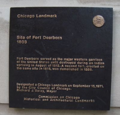
Site of Fort Dearborn
1803
Fort Dearborn served as the major western garrison of the United States until destroyed during an Indian uprising in August of 1812. A second fort, erected on the same site in 1816, was demolished in 1858.
Designated a Chicago Landmark on September 15, 1971, by the City Council of Chicago.
Richard J. Daley, Mayor
Erected 1971 by Commission of Chicago Historical and Architectural Landmarks.
Topics and series. This historical marker is listed in these topic lists: Forts and Castles • War of 1812. In addition, it is included in the Illinois, Chicago Landmarks Commission series list. A significant historical month for this entry is September 1788.
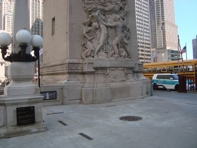
Location. 41° 53.305′ N, 87° 37.487′ W. Marker is in Chicago, Illinois, in Cook County. It is in The Loop District. Marker is on East Wacker Drive near North Michigan Avenue. This marker is located at the SW corner of the Michigan Avenue Bridge. Touch for map. Marker is at or near this postal address: 98 East Wacker Drive, Chicago IL 60601, United States of America. Touch for directions.
Other nearby markers. At least 8 other markers are within walking distance of this marker. Fort Dearborn (a few steps from this marker); Chicago River (a few steps from this marker); Rene Robert Cavalier Sieur de La Salle (a few steps from this marker); Old Fort Dearborn (within shouting distance of this marker); Regeneration (within shouting distance of this marker); 333 North Michigan Building (within shouting distance of this marker); Green Bay Road (about 300 feet away, measured in a direct line); Mather Tower (about 300 feet away). Touch for a list and map of all markers in Chicago.
Also see . . . Fort Dearborn - Wikipedia. (Submitted on September 28, 2011, by Barry Swackhamer of Brentwood, California.)
Credits. This page was last revised on January 30, 2023. It was originally submitted on September 28, 2011, by Barry Swackhamer of Brentwood, California. This page has been viewed 1,645 times since then and 80 times this year. Photos: 1, 2. submitted on September 28, 2011, by Barry Swackhamer of Brentwood, California. 3, 4, 5. submitted on December 7, 2014, by Allen C. Browne of Silver Spring, Maryland. • Bill Pfingsten was the editor who published this page.


