Bear Mountain in Rockland County, New York — The American Northeast (Mid-Atlantic)
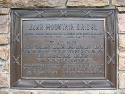
Bear Mountain Bridge
The first highway bridge to span the Hudson River south of Albany
Begun March 24th 1923 – Opened Nov. 27th 1924
To all who
With thought labor and loyalty have
Contributed to the construction of
This bridge and highway
This tablet is inscribed
Total length of bridge 2257 ft.
Height of towers 355 ft.
Diameter of cables 18 ins.
Length of suspended span 1632 ft.
Clear height above river 153 ft.
Number of wires in each cable 7252
Erected 1924.
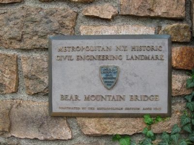
Topics and series. This historical marker is listed in this topic list: Bridges & Viaducts. In addition, it is included in the ASCE Civil Engineering Landmarks series list. A significant historical date for this entry is March 24, 1794.
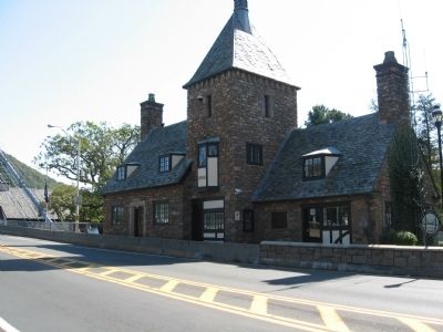
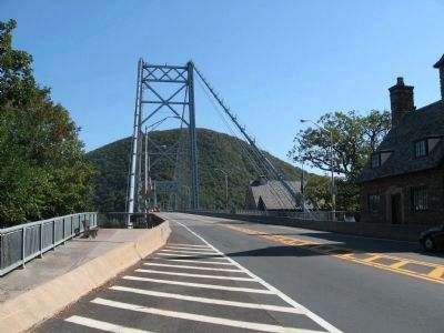
Location. 41° 19.197′ N, 73° 59.287′ W. Marker is in Bear Mountain, New York, in Rockland County. Marker is on U.S. 202, 0.2 miles east of U.S. 9W, on the right when traveling east. Located on the Bear Mountain Bridge Administration Building at the west end of the bridge. Touch for map. Marker is in this post office area: Bear Mountain NY 10911, United States of America. Touch for directions.
Other nearby markers. At least 8 other markers are within walking distance of this marker. The Bridge Builders (a few steps from this marker); A Strategic Location (a few steps from this marker); Popolopen Creek Trail to Fort Montgomery (within shouting distance of this marker); Fort Clinton (about 300 feet away, measured in a direct line); Appalachian Trail (about 400 feet away); Fort Clinton’s Outer Redoubt (about 400 feet away); The British Attempt to Divide the Colonies during the War of Independence (about 400 feet away); The Historic 1777 & 1779 Trails (about 400 feet away). Touch for a list and map of all markers in Bear Mountain.
Also see . . . Bear Mountain Bridge. Wikipedia entry (Submitted on October 9, 2011, by Michael Herrick of Southbury, Connecticut.)
Credits. This page was last revised on October 13, 2021. It was originally submitted on October 9, 2011, by Michael Herrick of Southbury, Connecticut. This page has been viewed 716 times since then and 28 times this year. Photos: 1, 2, 3, 4. submitted on October 9, 2011, by Michael Herrick of Southbury, Connecticut.


