Camden in Kershaw County, South Carolina — The American South (South Atlantic)
Camden - Strategic Key
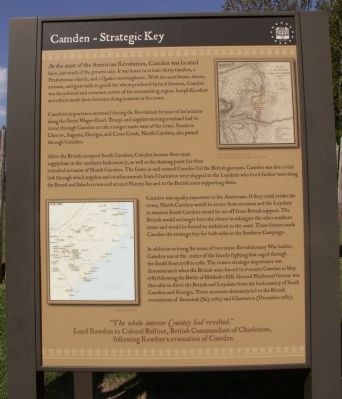
Camden’s importance increased during the Revolution because of its location along the Great Wagon Road. Troops and supplies moving overland had to travel through Camden or take a longer route west of the town. Roads to Cheraw, Augusta, Georgia, and Cross Creek, North Carolina, also passed through Camden.
After the British occupied South Carolina, Camden became their main supply base in the southern backcountry, as well as the starting point for their intended invasion of North Carolina. The farms in and around Camden fed the British garrison. Camden was also a vital link through which supplies and reinforcements from Charleston were shipped to the Loyalists who lived farther west along the Broad and Saluda rivers and around Ninety Six and to the British units supporting them.
Camden was equally important to the Americans. If they could retake the town, North Carolina would be secure from invasion and the Loyalists in western South Carolina would be cut off from British support. The British would no longer have the chance to subjugate the other southern states and would be forced to withdraw to the coast. These factors made Camden the strategic key for both sides in the Southern Campaign.
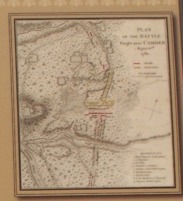
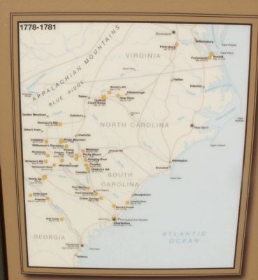
In addition to being the scene of two major Revolutionary War battles, Camden was at the center of the bloody fighting that raged through the South from 1778 to 1781. The town’s strategic importance was demonstrated when the British were forced to evacuate Camden in May 1781 following the Battle of Hobkirk’s Hill. General Nathanael Greene was then able to drive the British and Loyalists from the backcountry of South Carolina and Georgia. These successes ultimately led to the British evacuations of Savannah (July 1782) and Charleston (December 1782).
“The whole interior Country had revolted.” Lord Rawdon to Colonel Balfour, British Commandant of Charleston, following Rawdon’s evacuation of Camden
Topics. This historical marker is listed in this topic list: War, US Revolutionary. A significant historical month for this entry is May 1781.
Location. 34° 14.053′ N, 80° 36.25′ W. Marker is in Camden, South Carolina, in Kershaw County. Marker can be reached from Broad Street. Marker is located in the Historic
Camden Battle Site. Touch for map. Marker is in this post office area: Camden SC 29020, United States of America. Touch for directions.
Other nearby markers. At least 8 other markers are within walking distance of this marker. The Southern Campaign, Apr 1781 - Dec 1782 (here, next to this marker); The Southern Campaign, Aug 1780 - Apr 1781 (here, next to this marker); The Southern Campaign, Dec 1778 - Aug 1780 (here, next to this marker); The Fortified Post (a few steps from this marker); Palisade Wall (a few steps from this marker); Native Allies (within shouting distance of this marker); War in the Backcountry (within shouting distance of this marker); Women in the Revolution (about 300 feet away, measured in a direct line). Touch for a list and map of all markers in Camden.
Credits. This page was last revised on June 16, 2016. It was originally submitted on November 1, 2011, by Anna Inbody of Columbia, South Carolina. This page has been viewed 503 times since then and 12 times this year. Photos: 1, 2, 3, 4. submitted on November 1, 2011, by Anna Inbody of Columbia, South Carolina. • Craig Swain was the editor who published this page.


