Georgetown in Beaver County, Pennsylvania — The American Northeast (Mid-Atlantic)
Georgetown
Photographed by Mike Wintermantel, December 25, 2011
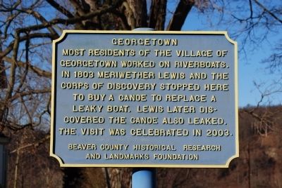
1. Georgetown Marker
Most residents of the village of Georgetown worked on riverboats. In 1803 Meriwether Lewis and the Corps of Discovery stopped here to buy a canoe to replace a leaky boat. Lewis later discovered the canoe also leaked. The visit was celebrated in 2003.
Erected by Beaver County Historical Research and Landmarks Foundation.
Topics and series. This historical marker is listed in this topic list: Notable Places. In addition, it is included in the Pennsylvania - Beaver County Historical Research and Landmarks Foundation series list. A significant historical year for this entry is 1803.
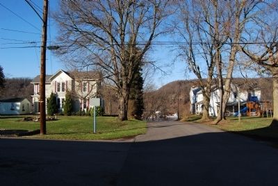
Location. 40° 38.537′ N, 80° 29.976′ W. Marker is in Georgetown, Pennsylvania, in Beaver County. It is at the intersection of 1st Street and Market Street, on the right when traveling west on 1st Street. Touch for map. Marker is in this post office area: Georgetown PA 15043, United States of America. Touch for directions.

Regionally, this marker is in Greater Pittsburgh. It is also in the American Northeast, in the Mid-Atlantic, and in the Ohio River Valley. Globally, it is in North America, the Western Hemisphere, the Western World,
this page online
Other nearby markers. At least 8 other markers are within one mile of this marker, measured as the crow flies: Down The Ohio (here, next to this marker); Saint Luke's Episcopal Church (about 500 feet away, measured in a direct line); Georgetown Veterans Memorial (about 600 feet away); a different marker also named Georgetown (approx. 0.2 miles away); The Penna - Virginia Boundary (approx. ¼ mile away); Smiths Ferry (approx. 0.4 miles away); The Sandy and Beaver Canal (approx. 0.7 miles away); The Point of Beginning (approx. one mile away). Touch for a list and map of all markers in Georgetown.
Also see . . . Beaver County Historical Research and Landmarks Foundation. Foundation website homepage (Submitted on December 25, 2011, by Mike Wintermantel of Pittsburgh, Pennsylvania.)
Photographed by Mike Wintermantel, December 25, 2011
2. Georgetown Marker
Credits. This page was last revised on March 28, 2022. It was originally submitted on December 25, 2011, by Mike Wintermantel of Pittsburgh, Pennsylvania. This page has been viewed 956 times since then and 46 times this year. Photos: 1, 2. submitted on December 25, 2011, by Mike Wintermantel of Pittsburgh, Pennsylvania.
