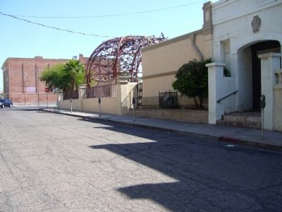
Downtown in Tucson in Pima County, Arizona — The American Mountains (Southwest)
Site of Arizona's Second Territorial Capitol
Source: Historical Markers within the Arizona Department of Transportation Right of Way. Prepared by: Roadside Development Section, April 1, 1997
Topics. This historical marker is listed in these topic lists: Government & Politics • Settlements & Settlers. A significant historical date for this entry is April 1, 1947.
Location. Marker has been reported missing. It was located near 32° 13.193′ N, 110° 58.275′ W. Marker was in Tucson, Arizona, in Pima County. It was in Downtown. Marker was on West Ochoa Street, on the right when traveling east. The marker location was on the south side of West Ochoa Street, between the convent and South Stone Avenue. Touch for map. Marker was at or near this postal address: 33 W Ochoa St, Tucson AZ 85701, United States of America. Touch for directions.
Other nearby markers. At least 8 other markers are within walking distance of this location. Corral Street (about 300 feet away, measured in a direct line); Charles O. Brown House (about 400 feet away); Jackson Street (about 400 feet away); Ochoa Street (about 500 feet away); Convent Street (about 600 feet away); August 20th Park (about 600 feet away); Scott Avenue (about 600 feet away); McCormick Street (about 700 feet away). Touch for a list and map of all markers in Tucson.
Credits. This page was last revised on June 16, 2016. It was originally submitted on January 9, 2012, by Bill Kirchner of Tucson, Arizona. This page has been viewed 655 times since then and 13 times this year. Photos: 1, 2. submitted on January 9, 2012, by Bill Kirchner of Tucson, Arizona. • Syd Whittle was the editor who published this page.

