Huntington Beach in Orange County, California — The American West (Pacific Coastal)
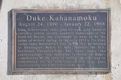
Duke Kahanamoku
August 24, 1890 - January 22, 1968
Photographed by Michael Kindig, January 25, 2012
1. Duke Kahanamoku Marker
Topics. This historical marker is listed in these topic lists: Asian Americans • Sports.
Location. 33° 39.434′ N, 118° 0.09′ W. Marker is in Huntington Beach, California, in Orange County. It is at the intersection of Pacific Coast Highway and Main Street, on the right when traveling north on Pacific Coast Highway. Touch for map. Marker is at or near this postal address: 116 Main Street, Huntington Beach CA 92648, United States of America. Touch for directions.

Regionally, this marker is in Greater Los Angeles and in the
this page online
Other nearby markers. At least 8 other markers are within 2 miles of this marker, measured as the crow flies: 126 Main Street (about 300 feet away, measured in a direct line); a different marker also named 126 Main Street (about 300 feet away); World's Largest Surfboard (about 700 feet away); Scout Cabin (approx. 0.8 miles away); P-38 Memorial (approx. 1.1 miles away); Ode to Desert Storm (approx. 1.4 miles away); Auditorium and Tower (approx. 1.4 miles away); The Queen's Rose Garden (approx. 1.4 miles away). Touch for a list and map of all markers in Huntington Beach.
Additional keywords. American Pacific Islanders
May 23, 2011
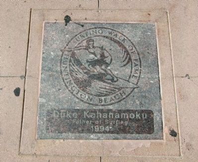
2. Duke Kahanamoku - Huntington Beach Surfing Walk of Fame Tile
Just a short walk nearby is the Huntington Beach Surfing Walk of Fame, with tiles embedded in the sidewalk honoring famous surfers, including Duke, the "Father of Surfing".
Photographed by Michael Kindig, January 25, 2012
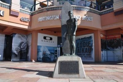
3. Duke Kahanamoku Marker and Statue
Credits. This page was last revised on November 6, 2019. It was originally submitted on January 25, 2012, by Michael Kindig of Elk Grove, California. This page has been viewed 3,297 times since then and 150 times this year. Photos: 1. submitted on January 25, 2012, by Michael Kindig of Elk Grove, California. 2. submitted on January 31, 2012. 3. submitted on January 25, 2012, by Michael Kindig of Elk Grove, California. • Syd Whittle was the editor who published this page.
