Cape Girardeau in Cape Girardeau County, Missouri — The American Midwest (Upper Plains)
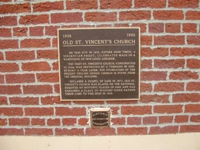
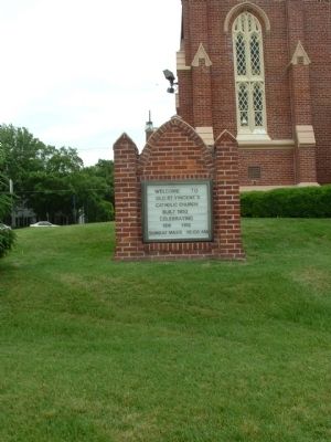
Old St. Vincent's Church
1838 ------ 1982
The first St. Vincent's Church, constructed in 1838, was destroyed by a tornado in 1850. Re-built a year later, the foundation of the present English Gothic church is stone from the original building.
Declared a Chapel of Ease in 1977, Old St. Vincent's Church was placed on the National Register of Historic Places in 1982 and has remained a place of worship since Father Timon came to this spot in 1833.
Topics. This historical marker is listed in this topic list: Churches & Religion. A significant historical year for this entry is 1833.
Location. 37° 18.048′ N, 89° 31.16′ W. Marker is in Cape Girardeau, Missouri, in Cape Girardeau County. Marker can be reached from the intersection of South Main Street and William Street, on the left when traveling north. Touch for map. Marker is in this post office area: Cape Girardeau MO 63701, United States of America. Touch for directions.
Other nearby markers. At least 8 other markers are within walking distance of this marker. Cape La Croix Creek (within shouting distance of this marker); B'nai Israel Synagogue (within shouting distance of this marker); The Red House Interpretive Center (within shouting distance of this marker); The Red House (within shouting distance of this marker); George Drouillard (within shouting distance of this marker); The Lewis and Clark Expedition Across Missouri (within shouting distance of this marker); Don Louis Lorimier / El Camino Real (within shouting distance of this marker); 1925 (about 300 feet away, measured in a direct line). Touch for a list and map of all markers in Cape Girardeau.
Credits. This page was last revised on June 16, 2016. It was originally submitted on January 29, 2012, by Ken Smith of Milan, Tennessee. This page has been viewed 541 times since then and 14 times this year. Photos: 1, 2, 3, 4. submitted on January 29, 2012, by Ken Smith of Milan, Tennessee. • Craig Swain was the editor who published this page.


