Near Leicester in Livingston County, New York — The American Northeast (Mid-Atlantic)
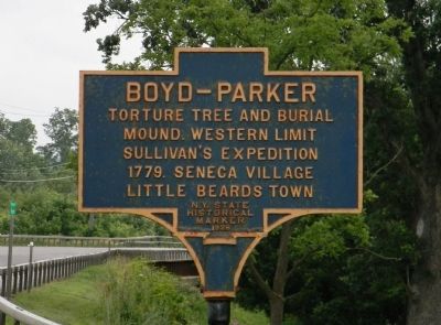
Boyd – Parker
Photographed by Paul Crumlish, June 25, 2011
1. Boyd — Parker Marker
Erected 1928 by New York State Historical Marker.
Topics. This historical marker is listed in this topic list: War, US Revolutionary. A significant historical year for this entry is 1779.
Location. 42° 46.614′ N, 77° 51.757′ W. Marker is near Leicester, New York, in Livingston County. It is on Cuylerville Road (Alternate U.S. 20) 0.4 miles east of Canandaigua Street, on the right when traveling east. The marker is located at the entrance to the Boyd Parker Memorial Park. Touch for map. Marker is in this post office area: Leicester NY 14481, United States of America. Touch for directions.

Regionally, this marker is in Upstate New York, specifically in Western New York, in the Finger Lakes, and in the Rochester Metropolitan Area. It is also in the American Northeast and in the Mid-Atlantic. Globally, it is in North America, the Western Hemisphere, the Western World, and the Anglosphere. Historically, it finds itself in what was once the Haudenosaunee (Iroquois) Confederacy, New Netherland, and
this page online
Other nearby markers. At least 8 other markers are within walking distance of this marker: Genesee Castle (within shouting distance of this marker); Routes of the Armies (within shouting distance of this marker); Boyd & Parker Park (within shouting distance of this marker); This wayside shrine marks the place (within shouting distance of this marker); The International Society of Arboriculture and the National Arborist Association (within shouting distance of this marker); Cuylerville (approx. 0.4 miles away); National Hotel (approx. half a mile away); A.R. Christiano Farm (approx. 0.6 miles away).
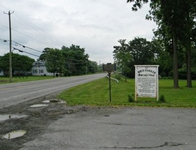
Photographed by Paul Crumlish, June 25, 2011
2. Wide view of the Boyd – Parker Marker
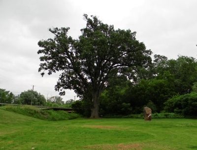
Photographed by Paul Crumlish, June 25, 2011
3. The Burr Oak
Tradition holds that Lt.Thomas Boyd was bound and tortured to the base of this tree.
Credits. This page was last revised on October 20, 2017. It was originally submitted on February 4, 2012, by PaulwC3 of Northern, Virginia. This page has been viewed 1,888 times since then and 160 times this year. Photos: 1, 2, 3. submitted on February 4, 2012, by PaulwC3 of Northern, Virginia.
