Geneseo in Livingston County, New York — The American Northeast (Mid-Atlantic)
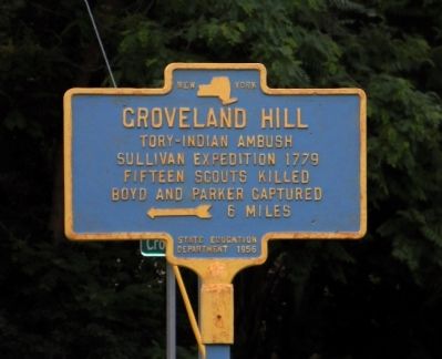
Groveland Hill
Tory-Indian ambush Sullivan Expedition 1779 Fifteen scouts killed Boyd and Parker capture 6 miles
Erected 1956 by New York State Education Department.
Topics. This historical marker is listed in this topic list: War, US Revolutionary. A significant historical year for this entry is 1779.
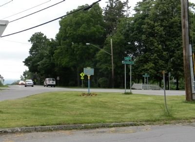
Location. 42° 47.531′ N, 77° 48.471′ W. Marker is in Geneseo, New York, in Livingston County. Marker is at the intersection of South Street (Alternate U.S. 20) and Groveland Road (County Road 10), on the right when traveling east on South Street. The marker is located in the traffic island at the intersection of South Street and Groveland Road. Touch for map. Marker is in this post office area: Geneseo NY 14454, United States of America. Touch for directions.
Other nearby markers. At least 8 other markers are within walking distance of this marker. Temple Hill (within shouting distance of this marker); History of Mining in the Genesee Valley (approx. 0.4 miles away); Cobblestone School (approx. 0.4 miles away); Site of Camp Union (approx. half a mile away); Geneseo Historic District (approx. half a mile away); Site of First Church (approx. half a mile away); Village Square (approx. half a mile away); Big Tree Lodge (approx. 0.6 miles away). Touch for a list and map of all markers in Geneseo.
Also see . . .
1. The Sullivan-Clinton Campaign-1779: The Groveland Ambush Sept. 12-14, 1779. Wemett website entry (Submitted on February 4, 2012, by PaulwC3 of Northern, Virginia.)
2. Groveland Ambuscade Monument. Town of Groveland website entry (Submitted on February 4, 2012, by PaulwC3 of Northern, Virginia.)
Credits. This page was last revised on December 29, 2021. It was originally submitted on February 4, 2012, by PaulwC3 of Northern, Virginia. This page has been viewed 706 times since then and 31 times this year. Photos: 1, 2. submitted on February 4, 2012, by PaulwC3 of Northern, Virginia.

