Neeses in Orangeburg County, South Carolina — The American South (South Atlantic)
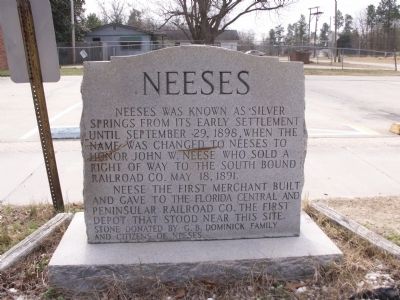
Neeses
Neeses was known as Silver Springs from its early settlement until September 29, 1898, when the name was changed to Neeses to honor Mayor John W. Neese who sold a right of way to the South Bound Railroad Co. May 18, 1891.
Neese the first merchant built and gave to the Florida Central and Peninsular Railroad Co. the first depot that stood near this site.
Stone donated by G.B. Dominick Family and citizens of Neeses.
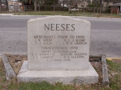
(Reverse):
Neeses
Merchants prior to 1900
J.W. Neese; H.L.J. Blume; T.J. Bolin; J.W.B.Chaplin
Town Council 1970
Henry M. Chaplin, Mayor; L.C. Bonnette; Roscoe Gleaton; F.F. Corbett; O.S. Gleaton; S.J. Tindal, Clerk
Erected 1970 by G.B. Dominick Family and citizens of Neeses.
Topics. This historical marker is listed in these topic lists: Industry & Commerce • Railroads & Streetcars • Settlements & Settlers. A significant historical month for this entry is May 1882.
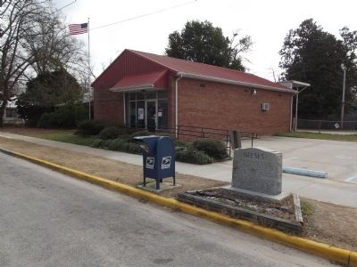
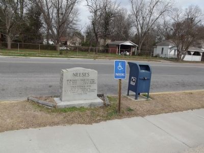
Location. 33° 31.896′ N, 81° 7.48′ W. Marker is in Neeses, South Carolina, in Orangeburg County. Marker is at the intersection of Rice Street and Silver Springs Road, on the left when traveling west on Rice Street. marker is located in front of the Post Office. Touch for map. Marker is in this post office area: Neeses SC 29107, United States of America. Touch for directions.
Other nearby markers. At least 8 other markers are within 11 miles of this marker, measured as the crow flies. Rocky Swamp Methodist Church and Cemetery (approx. 4.1 miles away); Rocky Swamp Rosenwald School (approx. 5.3 miles away); The Town Of North (approx. 5.9 miles away); Moorefield Memorial Highway (approx. 6˝ miles away); Great Branch School and Teacherage (approx. 7.1 miles away); Jeffcoats' Meeting House (approx. 9.4 miles away); Holman's Bridge (approx. 9˝ miles away); Old Indian Trail (approx. 10.1 miles away).
Credits. This page was last revised on June 16, 2016. It was originally submitted on February 8, 2012, by Anna Inbody of Columbia, South Carolina. This page has been viewed 1,042 times since then and 53 times this year. Photos: 1, 2, 3, 4. submitted on February 8, 2012, by Anna Inbody of Columbia, South Carolina. • Craig Swain was the editor who published this page.


