Sandy Run in Lexington County, South Carolina — The American South (South Atlantic)
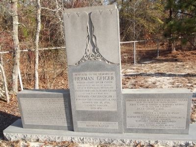
Herman Geiger
Herman Geiger
Father ~ Hans Jacob Gyger, Born 1679, at village of Wydnau, Parish of Diapololsau, Switzerland. Mother ~ Margareta Fearin Gyger of same place, born 1684. Herman Geiger (Gyger) Born (or Christened) Dec. 18, 1707, Married Feb. 26, 1734, Elizabeth Habluzel, Died 1751
Erected 1958 by the descendents of Herman Geiger
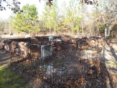
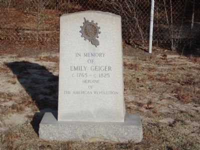
(Front left panel): Herman Geiger and his father, Hans Jacob Geiger, former Cantonal Governor in Switzerland, departed with their families, Sept. 1736 for Carolina. They arrived in Charleston, S.C., Feb. 1, 1737, and settled in the Congarees. Herman became an Indian Trader, and on occasion rendered assistance to the Governor of the Colony in meetings with the Indians. Some of his descendents served in the Cherokee War in 1759; and some have served in every war since. A son, John Geiger, buried in this cemetery, and a Grandson, Maj. Jacob Geiger, served their country in the Revolutionary war. A niece, Emily Geiger carried a message from one American Force to another.
(Front right panel):
Erected 1958 by The Descendents of Herman Geiger.
Topics. This historical marker is listed in these topic lists: Settlements & Settlers • War, US Revolutionary. A significant historical date for this entry is February 26, 1734.
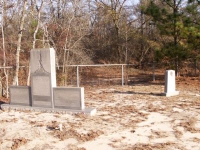
Location. 33° 51.699′ N, 81° 1.218′ W. Marker is in Sandy Run, South Carolina, in Lexington County. Marker can be reached from Old State Road (U.S. 176/21). marker is about 1/4 mile down dirt road within Eastman Property. Touch for map. Marker is in this post office area: Gaston SC 29053, United States of America. Touch for directions.
Other nearby markers. At least 8 other markers are within 7 miles of this marker, measured as the crow flies. Sandy Run Lutheran Church (approx. 5.3 miles away); Sandy Run Church / Christian Theus (approx. 5.3 miles away); Congaree Creek Earthworks (approx. 5.4 miles away); Camp Moore (approx. 5.9 miles away); Congaree Fort (approx. 6.2 miles away); William Earle Berne Beltway (approx. 6.8 miles away); Battle of Congaree Creek (approx. 6.9 miles away); African-American Heroes of the 371st Regiment (approx. 7 miles away).
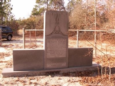
Photographed By Anna Inbody, January 7, 2012
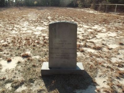
2. Herman Geiger Marker ~ Reverse
Dedicated to the Memory of
Herman Geiger
Father ~ Hans Jacob Gyger, Born 1679, at village of Wydnau, Parish of Diapolosau, Switzerland. Mother ~ Margareta Fearin Gyger of same place, born 1684. Herman Geiger (Gyger) Born (or Christened) Dec. 18, 1707, Married Feb. 26, 1734, Elizabeth Habluzel, Died 1751
Erected 1958 by the descendents of Herman Geiger
Credits. This page was last revised on June 16, 2016. It was originally submitted on February 10, 2012, by Anna Inbody of Columbia, South Carolina. This page has been viewed 1,737 times since then and 101 times this year. Photos: 1, 2, 3, 4, 5, 6, 7, 8, 9, 10. submitted on February 10, 2012, by Anna Inbody of Columbia, South Carolina. • Craig Swain was the editor who published this page.
