Huntingdon in Carroll County, Tennessee — The American South (East South Central)
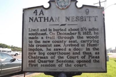
Nathan Nesbitt
Erected by Tennessee Historical Commission. (Marker Number 4A 9.)
Topics and series. This historical marker is listed in these topic lists: Government & Politics • Settlements & Settlers. In addition, it is included in the Tennessee Historical Commission series list. A significant historical month for this entry is December 1860.
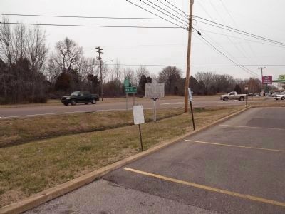
Location. 36° 0.421′ N, 88° 24.39′ W. Marker is in Huntingdon, Tennessee, in Carroll County. Marker is at the intersection of East Main Street (Business U.S. 70) and Buena Vista Road, on the right when traveling east on East Main Street. Touch for map. Marker is in this post office area: Huntingdon TN 38344, United States of America. Touch for directions.
Other nearby markers. At least 8 other markers are within 3 miles of this marker, measured as the crow flies. The Hawkins Cousins (approx. 0.6 miles away); Historic Thomas Park (approx. 0.8 miles away); Carroll County War Memorial (approx. 0.8 miles away); Oak Hill Cemetery (approx. 0.9 miles away); A Divided Land (approx. 1.3 miles away); Carroll County Veterans Monument (approx. 1.3 miles away); Mudslingers Studio (approx. 1.3 miles away); Isaac R. Hawkins (approx. 2.2 miles away). Touch for a list and map of all markers in Huntingdon.
Credits. This page was last revised on January 3, 2019. It was originally submitted on February 14, 2012, by Ken Smith of Milan, Tennessee. This page has been viewed 974 times since then and 31 times this year. Photos: 1. submitted on February 14, 2012, by Ken Smith of Milan, Tennessee. 2. submitted on February 19, 2012, by Ken Smith of Milan, Tennessee. • Bernard Fisher was the editor who published this page.

