Cockeysville in Baltimore County, Maryland — The American Northeast (Mid-Atlantic)
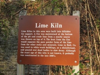
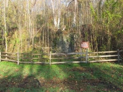
Lime Kiln
Topics. This historical marker is listed in this topic list: Industry & Commerce.
Location. 39° 30.416′ N, 76° 37.704′ W. Marker is in Cockeysville, Maryland, in Baltimore County. Marker can be reached from Paper Mill Road (Maryland Route 145) 1.2 miles east of York Road (Maryland Route 45), on the left when traveling east. Marker is on the trail, about 1/2 mile north of the parking lot. Touch for map. Marker is in this post office area: Cockeysville MD 21030, United States of America. Touch for directions.
Other nearby markers. At least 8 other markers are within 4 miles of this marker, measured as the crow flies. North Central Railroad Trail (approx. 0.4 miles away); Gilmor's Raid (approx. 0.4 miles away); Phoenix (approx. one mile away); Sparks (approx. 2.3 miles away); Hayfields (approx. 2˝ miles away); Clynmalira (approx. 2.9 miles away); "...To Those Who Served" (approx. 3 miles away); Third and Last County Almshouse (approx. 3.2 miles away). Touch for a list and map of all markers in Cockeysville.
Credits. This page was last revised on June 16, 2016. It was originally submitted on March 4, 2012, by F. Robby of Baltimore, Maryland. This page has been viewed 1,251 times since then and 31 times this year. Photos: 1, 2. submitted on March 4, 2012, by F. Robby of Baltimore, Maryland.

