Concordia in Cloud County, Kansas — The American Midwest (Upper Plains)
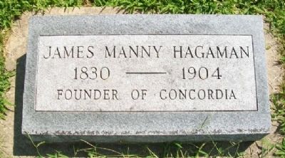
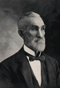
James Manny Hagaman
1830 - 1904
Topics. This historical marker is listed in this topic list: Settlements & Settlers.
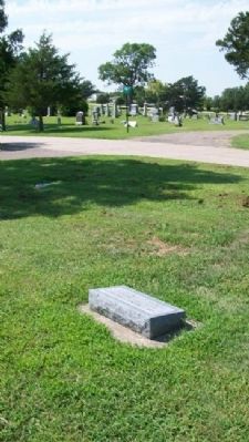
Location. 39° 33.515′ N, 97° 39.879′ W. Marker is in Concordia, Kansas, in Cloud County. Marker is in Pleasant Hill Cemetery. Touch for map. Marker is at or near this postal address: 444 East 18th Street, Concordia KS 66901, United States of America. Touch for directions.
Other nearby markers. At least 8 other markers are within walking distance of this marker. Civil War Soldiers and Sailors Memorial (within shouting distance of this marker); Davies-Crook American Legion Post 76 War Memorial (about 700 feet away, measured in a direct line); Kansas Orphan Riders (about 800 feet away); World Wars Memorial (approx. 0.2 miles away); Walter "Zeke" White (approx. 0.4 miles away); Gertrude Vale / Sister Eva Marie Vale (approx. 0.4 miles away); Genevieve Hunt / Sister Roberta Dreiling (approx. 0.4 miles away); Alberta Cole / Roberta Work Miller Slifer (approx. half a mile away). Touch for a list and map of all markers in Concordia.
Credits. This page was last revised on December 7, 2021. It was originally submitted on March 11, 2012, by William Fischer, Jr. of Scranton, Pennsylvania. This page has been viewed 524 times since then and 13 times this year. Photos: 1, 2. submitted on March 11, 2012, by William Fischer, Jr. of Scranton, Pennsylvania. 3. submitted on December 4, 2020, by Larry Gertner of New York, New York.


