Bay Oaks Harbor in Baytown in Harris County, Texas — The American South (West South Central)
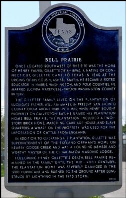
Bell Prairie
Photographed by Jim Evans, March 17, 2012
1. Bell Prairie Marker
Once located southwest of this site was the home of Henry Falvel Gillette (1816-1896). A native of Connecticut, Gillette came to Texas in 1840 at the urging of his cousin, Ashbel Smith. He became a noted educator in Harris, Washington, and Polk counties. He married Lucinda Maxey (1826-1901) of Washington County in 1842.
The Gillette family lived on the plantation of Lucinda's father, William Maxey, in present San Jacinto County from about 1848 until 1859, when Henry bought property on Galveston Bay. He named his plantation home Bell Prairie. The plantation included a two-story brick home, matching carriage house, and slave quarters. A wharf on the property was used for the importation of cattle from England.
In addition to operating his plantation, Gillette was superintendent of the Bayland Orphan's Home on nearby Goose Creek and was a founding member and worthy master of the Cedar Bayou Masonic Lodge.
Following Henry Gillette's death, Bell Prairie remained in the family until the mid-20th century. The plantation home was severely damaged in the 1900 hurricane and burned to the ground after being struck by lightning in the 1915 storm.
Erected 1989 by Texas Historical Commission. (Marker Number 10613.)
Topics. This historical marker is listed in this topic list: Settlements & Settlers. A significant historical year for this entry is 1840.
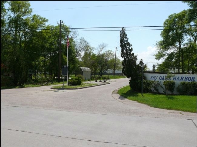
Location. 29° 42.017′ N, 94° 56.529′ W. Marker is in Baytown, Texas, in Harris County. It is in the Bay Oaks Harbor. It is at the intersection of Harbor View Boulevard and Tri City Beach Road, in the median on Harbor View Boulevard. Touch for map. Marker is in this post office area: Baytown TX 77523, United States of America. Touch for directions.

Regionally, this marker is in the Houston Metropolitan Area. It is also in the American South and on the Gulf
this page online
Other nearby markers. At least 8 other markers are within 3 miles of this marker, measured as the crow flies: Ashbel Smith M.D. (approx. 1.2 miles away); Baytown Mexican School (approx. 1.8 miles away); Goose Creek School Community No. 9 (approx. 2.4 miles away); City of Pelly (approx. 2.6 miles away); K'Nesseth Israel Synagogue (approx. 2.8 miles away); City of Baytown (approx. 2.8 miles away); George Washington Carver High School (approx. 2.8 miles away); Baytown Post Office (approx. 2.9 miles away). Touch for a list and map of all markers in Baytown.
Photographed by Jim Evans, March 17, 2012
2. Bell Prairie Marker
Credits. This page was last revised on February 1, 2023. It was originally submitted on March 17, 2012, by Jim Evans of Houston, Texas. This page has been viewed 1,476 times since then and 41 times this year. Photos: 1, 2. submitted on March 17, 2012, by Jim Evans of Houston, Texas. • Bernard Fisher was the editor who published this page.
