Near Westmoreland in Oneida County, New York — The American Northeast (Mid-Atlantic)
Utica Area
Historic New York
Utica Area
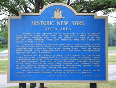
Situated on the important Mohawk Valley route between the Hudson River and the Great Lakes, Utica has long been a travel crossroads. Indian trails converged there, and Fort Schuyler was built on the site in 1758. The community which grew around the fort's ruins became the village of Utica in 1798.
During the American Revolution, patriot militia under General Nicholas Herkimer at Oriskany on August 6, 1777, halted an invasion by the British compelling them to raise the siege of Fort Stanwix (Rome). Tories and Indians raided Mohawk Valley communities until 1781. With peace, land speculators reopened the area to settlement.
Governor De Witt Clinton at Rome in 1817 started the construction of the Erie Canal, completed in 1825. The Erie Canal, its Chenango branch to Binghamton (1836) and railroad service (1837) increased Utica's importance as a transportation center, and the area prospered. Industrial production started early with textile mills along Sauquoit and Oriskany Creeks. At Ilion, Eliphalet Remington pioneered in manufacturing firearms. Rome became famous for its iron, copper and brass works.
Makers of electrical and electronic equipment have replaced textile factories, while fertile farmlands continue to provide dairy products.
Erected 1965 by The Education Department of the State of New York and the N.Y.S. Thruway Authority.
Topics and series. This historical marker is listed in these topic lists: Industry & Commerce • Settlements & Settlers • War, US Revolutionary. In addition, it is included in the Erie Canal, and the Historic New York State series lists. A significant historical year for this entry is 1758.
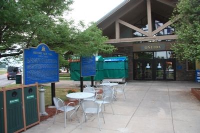
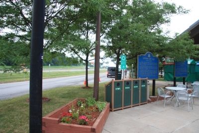
Location. 43° 7.517′ N, 75° 24.887′ W. Marker is near Westmoreland, New York, in Oneida County. Marker is on New York State Thruway - East (Interstate 90) west of New York State Route 233, on the right when traveling east. This historic marker is located at the Oneida Rest Stop Area, along the eastbound lane of the New York State Thruway, just prior to the exit for State Route 233. Touch for map. Marker is in this post office area: Westmoreland NY 13490, United States of America. Touch for directions.
Other nearby markers. At least 8 other markers are within 5 miles of this marker, measured as the crow flies. Steuben Memorial (here, next to this marker); Welcome to Westmoreland (approx. 0.8 miles away); Foundry (approx. 0.9 miles away); Birthplace of Samuels Eells (approx. one mile away); Clark Mills (approx. 3 miles away); James Dean Home (approx. 3.6 miles away); Washington Tract (approx. 4.1 miles away); General Herkimer's Troops (approx. 4.2 miles away). Touch for a list and map of all markers in Westmoreland.
Credits. This page was last revised on June 16, 2016. It was originally submitted on April 12, 2012, by Dale K. Benington of Toledo, Ohio. This page has been viewed 579 times since then and 25 times this year. Photos: 1, 2, 3. submitted on April 12, 2012, by Dale K. Benington of Toledo, Ohio.


