Central Vancouver in Metro Vancouver, British Columbia — Canada’s West Coast (North America)
Ferguson Point
Photographed by Andrew Ruppenstein, July 3, 2011
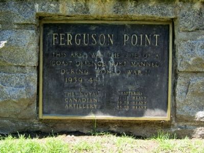
1. Ferguson Point Marker
1939-1945
by The Royal Canadian Artillery
Batteries
31st Heavy
58th Heavy
85th Heavy
Topics. This historical marker is listed in this topic list: War, World II.
Location. 49° 18.068′ N, 123° 9.478′ W. Marker is in Vancouver, British Columbia, in Metro Vancouver. It is in Central Vancouver. It is on Stanley Park Drive, on the right when traveling south. Touch for map. Marker is at or near this postal address: 7501 Stanley Park Drive, Vancouver BC V6G 3E7, Canada. Touch for directions.

Regionally, this marker is on the Lower Mainland and in Coast & Mountains. Globally, it is in North America, in the Cascade Range, in the Inside Passage, on the Ring of Fire, on the Pacific Rim, in the Western Hemisphere, in the Western World, and in the Anglosphere. Historically, it finds itself in what was once a British colony.
Other nearby markers. At least 8 other markers are within 2 kilometers of this marker, measured as the crow flies: Shakespeare Garden (approx. 1.5 kilometers away); Lions Gate Bridge
this page online
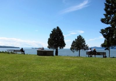
More about this marker. The marker is mounted to a long, low stone monument situated on the lawn of The Teahouse Restaurant, at Ferguson Point. Stanley Park Drive, which is one way and loops through the Park, goes right by the restaurant.
Photographed by Andrew Ruppenstein, July 3, 2011
2. Ferguson Point Marker - wide view, looking west
The marker, barely visible here because of the shadow, is mounted to a low stone monument on the lawn in front of the Teahouse Restaurant. Looking west are superb views of English Bay and the entrance to the Burrard Inlet.
via Fort Wiki, unknown
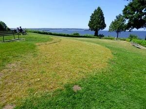
3. Outline of the Buried Ferguson Point Battery
Credits. This page was last revised on December 22, 2025. It was originally submitted on April 17, 2012, by Andrew Ruppenstein of Lamorinda, California. This page has been viewed 1,011 times since then and 37 times this year. Photos: 1, 2. submitted on April 17, 2012, by Andrew Ruppenstein of Lamorinda, California. 3. submitted on May 22, 2021, by Larry Gertner of New York, New York. • Bill Pfingsten was the editor who published this page.
