Watsonville in Santa Cruz County, California — The American West (Pacific Coastal)
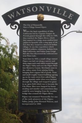
The City of Watsonville
Once a Village Named Pájaro
Years later in 1852, a small village name Pájaro was laid out along a narrow and dusty stagecoach road which wound through the Pájaro Valley and over the Pájaro River to Monterey County. Merchants came to the valley, many from mining fields, bringing their wagons full of goods. Tents and small roughly framed buildings sprang up on the main street first called Pájaro Street. Spanish cattle often were herded through the village and stopped to graze in an open field which was to become the City Plaza. Men were hanged for horse stealing and murder and sometimes they could be seen hanging from the wooden bridge that crossed the Pájaro River.
Pájaro was renamed Watsonville for one of the early pioneers of the Pájaro Valley, Judge John Howard Watson, and incorporated in 1868.
Topics and series. This historical marker is listed in this topic list: Settlements & Settlers. In addition, it is included in the Portolá Expedition series list. A significant historical year for this entry is 1769.
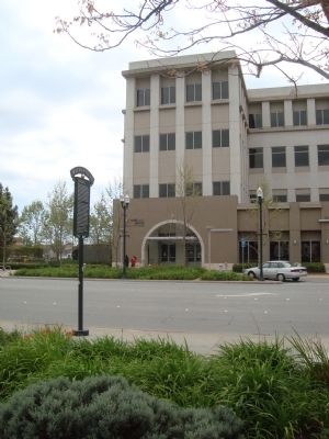
Location. 36° 54.518′ N, 121° 45.288′ W. Marker is in Watsonville, California, in Santa Cruz County. Marker is on Main Street south of Maple Avenue, on the left when traveling south. Touch for map. Marker is at or near this postal address: 250 Main Street, Watsonville CA 95076, United States of America. Touch for directions.
Other nearby markers. At least 8 other markers are within walking distance of this marker. Porter Building (about 300 feet away, measured in a direct line); A Year to Remember in Watsonville (about 600 feet away); This Gun Was Used (about 800 feet away); The City Plaza (about 800 feet away); The Lettunich Building (approx. 0.2 miles away); The Mansion House (approx. 0.2 miles away); Kalich Building (approx. 0.2 miles away); Judge Julius Lee House (approx. Ľ mile away). Touch for a list and map of all markers in Watsonville.
Credits. This page was last revised on June 16, 2016. It was originally submitted on April 26, 2012, by Barry Swackhamer of Brentwood, California. This page has been viewed 745 times since then and 43 times this year. Photos: 1, 2. submitted on April 26, 2012, by Barry Swackhamer of Brentwood, California. • Syd Whittle was the editor who published this page.

