Highland Park in Lake County, Illinois — The American Midwest (Great Lakes)
Fort Sheridan
Photographed by Bill Kirchner, April 23, 2012
1. Fort Sheridan Marker
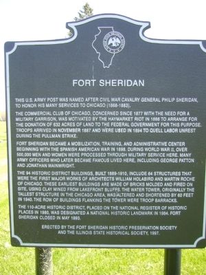
The Commercial Club of Chicago, concerned since 1877 with the need for a military garrison, was motivated by the Haymarket Riot in 1886 to arrange for the donation of 632 acres of land to the Federal Government for this purpose. Troops arrived in November 1887 and were used in 1894 to quell labor unrest during the Pullman strike.
Fort Sheridan became a mobilization, training, and administrative center beginning with the Spanish American War in 1898. During World War II, over 500,000 men and women were processed through military service here. Many Army officers who later became famous lived here, including George Patton and Jonathan Wainwright.
The 94 Historic District buildings, built 1889-1910, include 64 structures that were the first major works of architects William Holabird and Martin Roche of Chicago. These earliest buildings are made of bricks molded and fired on site, using clay mined from lakefront bluffs. The water tower, originally the tallest structure in the Chicago area, was
this page online
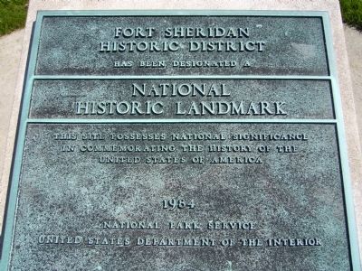
The 110-acre Historic District, placed on the National Register of Historic Places in 1980, was designated a National Historic Landmark in 1984. Fort Sheridan closed in 1993.
Erected 1997 by The Fort Sheridan Historic Preservation Society and the Illinois State Historical Society.
Topics and series. This historical marker is listed in this topic list: Forts and Castles. In addition, it is included in the Illinois State Historical Society, and the National Historic Landmarks series lists. A significant historical month for this entry is November 1887.
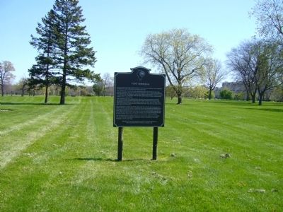
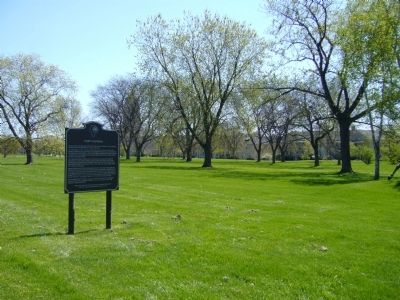
Location. 42° 13.014′ N, 87° 48.969′ W. Marker is in Highland Park, Illinois, in Lake County. It is on Leonard Wood West, on the left when traveling south. Marker is near the flag pole. Touch for map. Marker is in this post office area: Highland Park IL 60035, United States of America. Touch for directions.

Regionally, this marker is in Greater Chicago. It is also in the American Midwest. Globally, it is in North America, on the Great Lakes, in the Western Hemisphere, in the Western
Photographed by Bill Kirchner, April 23, 2012
2. Fort Sheridan Marker
Other nearby markers. At least 8 other markers are within 6 miles of this marker, measured as the crow flies: A different marker also named Fort Sheridan (a few steps from this marker); The Water Tower (approx. 0.2 miles away); Site of the First Public Building (approx. 2.3 miles away); The Francis Stupey Log Cabin (approx. 2½ miles away); McKinlock Post 264 American Legion Veterans Memorial (approx. 3.3 miles away); Tyler Gate (approx. 4.7 miles away); This Indian Trail Tree (approx. 5 miles away); The Dwyer Settlement in Lake County, Illinois (approx. 5.1 miles away). Touch for a list and map of all markers in Highland Park.
Photographed by Bill Kirchner, April 23, 2012
3. Fort Sheridan Marker
Photographed by Bill Kirchner, April 23, 2012
4. National Historic Landmark Marker
Historic District
Has been designated a
National
Historic Landmark
This site possesses national significance
In commemorating the history of the
United States of America
1984
Photographed by Bill Kirchner, April 23, 2012
5. National Historic Landmark Marker
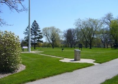
Fort Sheridan Marker is in the background.
Photographed by Unknown
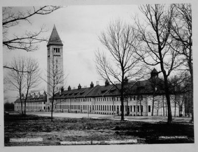
6. Fort Sheridan - Water Tower-Barracks complex looking southeast across the parade grounds
Significance: The Infantry Barracks together with the Water Tower (Building No. 49) to which it is connected and a similar building (Building No. 50) which is joined to the opposite side of the Tower form an impressive complex over 1000 feet long. These buildings, among the first to be constructed on the post, dominate the southern side of the parade grounds and serve as the post's best known landmark. Building No. 48 was designed by Holabird and Roche as Infantry Barracks and Headquarters. It was later used as Artillery Barracks and had a machine gun room in the basement. In 1967 the building became the headquarters of the Fifth Army.... - Historic American Building Survey
Credits. This page was last revised on June 16, 2016. It was originally submitted on May 20, 2012, by Bill Kirchner of Tucson, Arizona. This page has been viewed 1,798 times since then and 97 times this year. Photos: 1, 2, 3, 4, 5. submitted on May 20, 2012, by Bill Kirchner of Tucson, Arizona. 6. submitted on May 21, 2012. • Bill Pfingsten was the editor who published this page.
