Medford Street / The Neck in Boston in Suffolk County, Massachusetts — The American Northeast (New England)
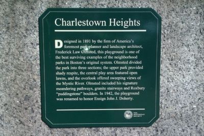
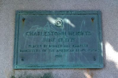
Charlestown Heights
Erected by The Bostonian Society.
Topics and series. This historical marker is listed in these topic lists: Charity & Public Work • Horticulture & Forestry. In addition, it is included in the Daughters of the American Revolution series list. A significant historical year for this entry is 1891.
Location. 42° 22.895′ N, 71° 4.062′ W. Marker is in Boston, Massachusetts, in Suffolk County. It is in Medford Street / The Neck. Marker is on Bunker Hill Street, 0 miles west of Mead St, on the left when traveling east. Marker is on the right side of the southeast entrance gate at Doherty Playground. Touch for map. Marker is at or near this postal address: 341 Bunker Hill St, Charlestown MA 02129, United States of America. Touch for directions.
Other nearby markers. At least 8 other markers are within walking distance of this marker. A different marker also named Charlestown Heights (within shouting distance of this marker); Charlestown Landing No. 1 (approx. 0.2 miles away); Bunker Hill Burying Ground (approx. 0.3 miles away); Phipps Street Burying Ground (approx. 0.3 miles away); The Line of Rail Fence and Grass Protection (approx. 0.3 miles away); The Rail Fence and Grass Line (approx. half a mile away); United States Gate (approx. half a mile away); Charlestown Five Cent Savings Bank (approx. half a mile away). Touch for a list and map of all markers in Boston.
Credits. This page was last revised on January 30, 2023. It was originally submitted on May 20, 2012, by Matt Gilbertson of Medford, Massachusetts. This page has been viewed 448 times since then and 21 times this year. Photos: 1. submitted on May 20, 2012, by Matt Gilbertson of Medford, Massachusetts. 2. submitted on May 21, 2012, by Matt Gilbertson of Medford, Massachusetts. • Bill Pfingsten was the editor who published this page.

