Near Summerhaven in Pima County, Arizona — The American Mountains (Southwest)
Lemmon Rock Lookout Tower
Coronado National Forest
Photographed by Fred Taylor, May 19, 2012
1. Lemmon Rock Lookout Tower Marker
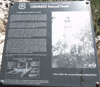
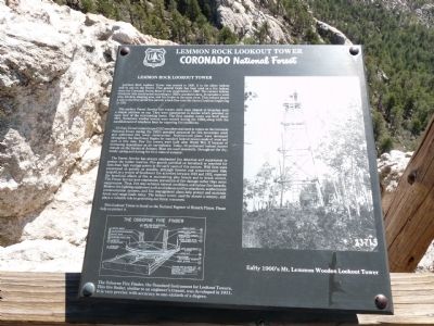
The earliest Forest Service fire towers were trees cleared of branches with a simple platform on top. They were constructed in locales which provided an open view of the surrounding forest. The first wooden tower was built about 1915. Numerous wooden towers were erected during the 1920's, along with the establishment of telephone lines for reporting fire conditions.
Civilian Conservation Corps (CCC) enrollees stationed at camps on the Coronado National Forest during the 1930's provided personnel for fire prevention work and additional fire tower construction. Architectural plans were developed throughout the Southwest Region for standard
this page online
The Forest Service has always emphasized fire detection and suppression to protect the timber reserves. Fire guards patrolled on horseback or searched for fires from high vantage points in the early years of this century. Wild fires were suppressed as quickly as possible, although forester and conservationist Aldo Leopold, in a review of Southwest fire activities between 1919 and 1923, reported the beneficial effects of fire in maintaining pine forests and in brush control. The Forest Service now emphasizes prevention of fire damage rather than strict suppression. Thus, fire may enhance natural conditions and reduce fire hazards. Modern fire fighting equipment such as airplanes and fire retardants, sophisticated communication systems, and fire management plans help protect and maintain forest and range lands today. The
Photographed by Fred Taylor, May 19, 2012
2. Lemmon Rock Lookout Tower Marker
This Lookout Tower is listed on the National Register of Historic Place. Please help us to protect it.
Erected by Coronado National Forest.
Topics and series. This historical marker is listed in these topic lists: Disasters • Horticulture & Forestry. In addition, it is included in the Civilian Conservation Corps (CCC) series list. A significant historical year for this entry is 1928.
Location. 32° 26.102′ N, 110° 47.364′ W. Marker is near Summerhaven, Arizona, in Pima County. It can be reached from no nearby road. It is a short (0.6 mile) hike to reach the Lemmon Rock Lookout Tower Marker.
Directions to hike: Take the Catalina Highway off Tanque Verde Road in Tucson. Drive 4.2 miles to the Forest boundary and continue 28 miles, past Mt. Lemmon Ski Valley, to the power substation on Radio Ridge. A parking area is on the left, about a mile past Mt. Lemmon Ski Valley, near the end of Observatory Road.
From the parking area follow the Mt. Lemmon trail, on the south side of the power substation, 0.45 miles southwest to the
Photographed by Fred Taylor, May 19, 2012
3. Lemmon Rock Lookout Tower
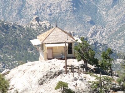
Lemmon Rock Lookout Tower Marker is just to the right of the power pole.

Regionally, this marker is in the Sky Islands, in the Sonoran Desert, in the Phoenix Metropolitan Area, and specifically in the Tucson Metro Metropolitan Area. It is also in the American Borderlands and in the Southwest. Globally, it is in North America, the Western Hemisphere, the Western World, and the Anglosphere. Historically, it finds itself in what was once New Spain and also the Gadsden Purchase.
Other nearby markers. At least 8 other markers are within 10 miles of this marker, measured as the crow flies: Keeping Watch (approx. 0.4 miles away); Two "M"s in Lemmon? (approx. 0.4 miles away); The San Pedro River Valley (approx. 6.3 miles away); Honorable Frank Harris Hitchcock (approx. 6.3 miles away); Catalina Federal Honor Camp (approx. 7.8 miles away); Frog Mountain (approx. 9.6 miles away); DeGrazia Gallery In the Sun (approx. 9.9 miles away); La Casa Del High Jinks (approx.
Photographed by Fred Taylor, May 19, 2012
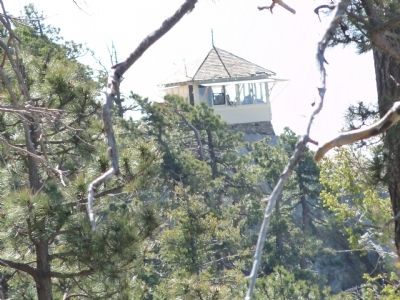
4. Lemmon Rock Lookout Tower
Another marker is no longer nearby. Cañada Del Oro (was approx. 9.1 miles away but has been confirmed missing).

Photographed by Fred Taylor, May 19, 2012
5. Osborne Fire Finder and Fire Lookout Ranger
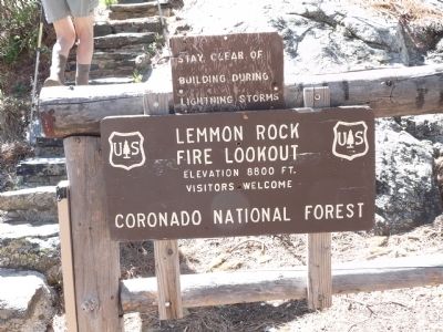
Photographed by Fred Taylor, May 19, 2012
6. Sign at bottom of stairs leading up to lookout tower.
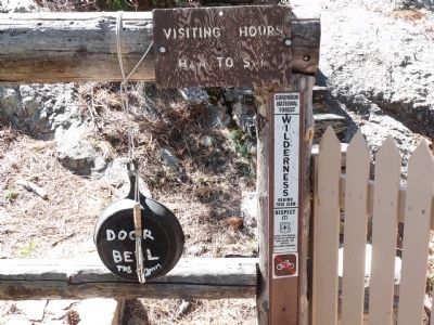
Photographed by Fred Taylor, May 19, 2012
7. Door Bell for Lemmon Rock Lookout Tower
Sound the "bell" to let the ranger know you are coming.
Credits. This page was last revised on January 26, 2026. It was originally submitted on May 21, 2012, by Bill Kirchner of Tucson, Arizona. This page has been viewed 5,367 times since then and 462 times this year. Photos: 1, 2, 3, 4, 5, 6, 7. submitted on May 21, 2012, by Bill Kirchner of Tucson, Arizona. • Syd Whittle was the editor who published this page.
