Near Leasburg in Crawford County, Missouri — The American Midwest (Upper Plains)
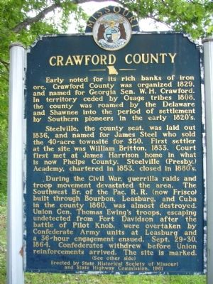
Crawford County
Early noted for its rich banks of iron ore, Crawford County was organized 1829, and named for Georgia Sen. W.H. Crawford. In territory ceded by Osage tribes 1808, the county was roamed by the Delaware and Shawnee into the period of settlement by Southern pioneers in the early 1820's.
Steelville, the county seat, was laid out 1836, and named for James Steel who sold the 40-acre townsite for $50. First settler at the site was William Britton, 1833. Court first met at James Harrison home in what is now Phelps County. Steelville (Presby.) Academy, chartered in 1853, closed in 1880's.
During the Civil War, guerrilla raids and troop movement devastated the area. The Southwest Br. of the Pac. R.R. (now Frisco) built through Bourbon, Leasburg, and Cuba in the county 1860, was almost destroyed. Union Gen. Thomas Ewing's troops, escaping undetected from Fort Davidson after the battle of Pilot Knob, were overtaken by Confederate Army units at Leasburg and a 36-hour engagement ensued, Sept. 29-30, 1864. Confederates withdrew before Union reinforcements arrived. The site is marked.
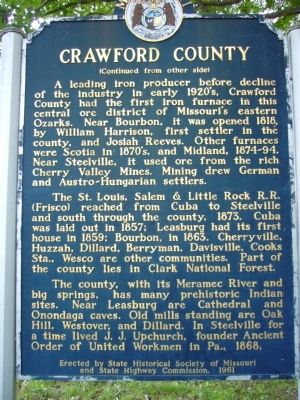
Side B:
A leading iron producer before decline of the industry in early 1920's, Crawford County had the first iron furnace in this central ore district of Missouri's eastern Ozarks. Near Bourbon, it was opened 1818, by William Harrison, first settler in the county, and Josiah Reeves. Other furnaces were Scotia in 1870's and Midland, 1874-94. Near Steelville, it used ore from the rich Cherry Valley Mines. Mining drew German and Austro-Hungarian settlers.
The St. Louis, Salem & Little Rock R.R. (Frisco) reached from Cuba to Steelville and south through the county, 1873. Cuba was laid out in 1857; Leasburg had its first house in 1859; Bourbon, in 1863. Cherryville, Huzzah, Dillard, Berryman, Davisville, Cooks Sta., Wesco are other communities. Part of the county lies in Clark National Forest.
The county with its Meramec River and big springs, has many pre-historic Indian sites. Near Leasburg are Cathedral and Onondaga caves. Old mills standing are Oak Hill, Westover, and Dillard. In Steelville for a time lived J.J. Upchurch, founder Ancient Order of United Workmen in PA., 1868.
Erected 1961 by State Historical Society of Missouri and State Highway Commission.
Topics and series. This historical marker is listed in this topic list: Settlements & Settlers. In addition, it is included in the Missouri, The State Historical Society of series list. A significant historical date for this entry is September 29, 1886.
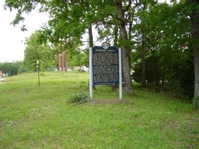
Location. 38° 7.111′ N, 91° 18.819′ W. Marker is near Leasburg, Missouri, in Crawford County. Marker is on Missouri Route H, on the right when traveling south. Marker is just south of I-44 (exit 214), north of Leasburg. Touch for map. Marker is in this post office area: Leasburg MO 65535, United States of America. Touch for directions.
Other nearby markers. At least 8 other markers are within 7 miles of this marker, measured as the crow flies. Battle of Leasburg (approx. 1.9 miles away); The Osage Trail (approx. 5.9 miles away); The Beginning (approx. 5.9 miles away); Expansion of America (approx. 5.9 miles away); Today's Warriors (approx. 5.9 miles away); A Time of Sadness (approx. 5.9 miles away); Bette Davis (approx. 6 miles away); Mayor Al West (approx. 6.2 miles away).
Credits. This page was last revised on June 16, 2016. It was originally submitted on May 24, 2012, by Bill Kirchner of Tucson, Arizona. This page has been viewed 856 times since then and 78 times this year. Photos: 1, 2, 3. submitted on May 24, 2012, by Bill Kirchner of Tucson, Arizona. • Craig Swain was the editor who published this page.


