Ponca City in Kay County, Oklahoma — The American South (West South Central)
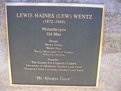
Lewis Haines (Lew) Wentz
(1872-1949)
Oil Man
Donor:
Wentz Camp,
Wentz Pool
Wentz Municipal Golf Course
Ponca City, Oklahoma
Founder:
The Society For Crippled Children
University of Oklahoma Student Loan Fund
Oklahoma State University Student Loan Fund
'He Always Gave'
Topics. This historical marker is listed in this topic list: Charity & Public Work.
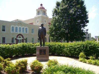
Location. 36° 42.202′ N, 97° 4.65′ W. Marker is in Ponca City, Oklahoma, in Kay County. Marker is at the intersection of East Grand Avenue and South 6th Street, on the left when traveling west on East Grand Avenue. Marker is on the southwest corner. Touch for map. Marker is in this post office area: Ponca City OK 74601, United States of America. Touch for directions.
Other nearby markers. At least 8 other markers are within 8 miles of this marker, measured as the crow flies. Ponca City Library (within shouting distance of this marker); E. W. Marland (about 300 feet away, measured in a direct line); Royal Air Force (RAF) Memorial (approx. 1.9 miles away); Ponca Military Academy (approx. 2˝ miles away); "White House" (approx. 7.1 miles away); Native American Involvement ...in the 101 Ranch (approx. 7.1 miles away); 101 Ranch (approx. 7.1 miles away); 101 Dairy Barn Vent from Dairy Barn (approx. 7.2 miles away). Touch for a list and map of all markers in Ponca City.
Credits. This page was last revised on June 16, 2016. It was originally submitted on May 27, 2012, by Bill Kirchner of Tucson, Arizona. This page has been viewed 681 times since then and 17 times this year. Photos: 1, 2. submitted on May 27, 2012, by Bill Kirchner of Tucson, Arizona. • Bernard Fisher was the editor who published this page.

