Galveston in Galveston County, Texas — The American South (West South Central)
Galveston Office of the National Weather Service
Photographed by Jim Evans, June 9, 2012
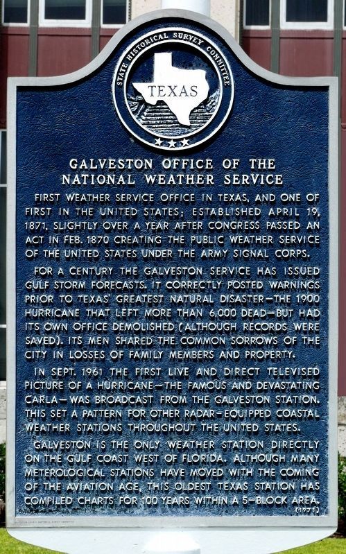
1. Galveston Office of the National Weather Service Marker
For a century the Galveston service has issued Gulf storm forecasts. It correctly posted warnings prior to Texas' greatest natural disaster -- the 1900 hurricane that left more than 6,000 dead -- but had its own office demolished (although records were saved). Its men shared the common sorrows of the city in losses of family members and property.
In Sept. 1961 the first live and direct televised picture of a hurricane—the famous and devastating Carla—was broadcast from the Galveston station. This set a pattern for other radar-equipped coastal weather stations throughout the United States.
Galveston is the only weather station directly on the Gulf Coast west of Florida. Although many meteorological stations have moved with the coming of the aviation age, this oldest Texas station has compiled charts for 100 years within a 5-block area.
Erected 1971 by State Historical Survey Committee. (Marker Number 7473.)
Topics. This historical marker is listed in this topic list: Government & Politics. A significant historical date for this entry is April 19, 1935.
Location. 29° 18.154′ N, 94° 47.739′ W. Marker is in Galveston, Texas, in Galveston County. It is at the intersection of 25th Street and Avenue F, on the right when traveling south on 25th Street. Touch for map. Marker is at or near this postal address: 601 25th Street, Galveston TX 77550, United States of America. Touch for directions.

Regionally, this marker is in the Houston Metropolitan Area. It is also in the American South and on the Gulf Coast. Globally, it is in North America, a
this page online
Other nearby markers. At least 8 other markers are within walking distance of this marker: Original Oleander Planting in Galveston (approx. 0.2 miles away); Texas Society, Sons of the American Revolution (approx. 0.2 miles away); The Rosenberg Library (approx. 0.2 miles away); The Eugenia & George Sealy Pavilion (approx. 0.2 miles away); First Baptist Church of Galveston (approx. 0.2 miles away); Trinity Protestant Episcopal Church (approx. ¼ mile away); Southwestern Telegraph and Telephone Building (approx. ¼ mile away); The Moody Home (approx. ¼ mile away). Touch for a list and map of all markers in Galveston.
Other markers no longer nearby. Open Gates (was approx. 0.2 miles away but has been confirmed missing); Ashton Villa, 1859 (was approx. ¼ mile away but has been confirmed missing).
More about this marker. Incise on base: Galveston County Historical Survey Committee
Regarding Galveston Office of the National Weather Service. The
Photographed by Jim Evans, June 9, 2012
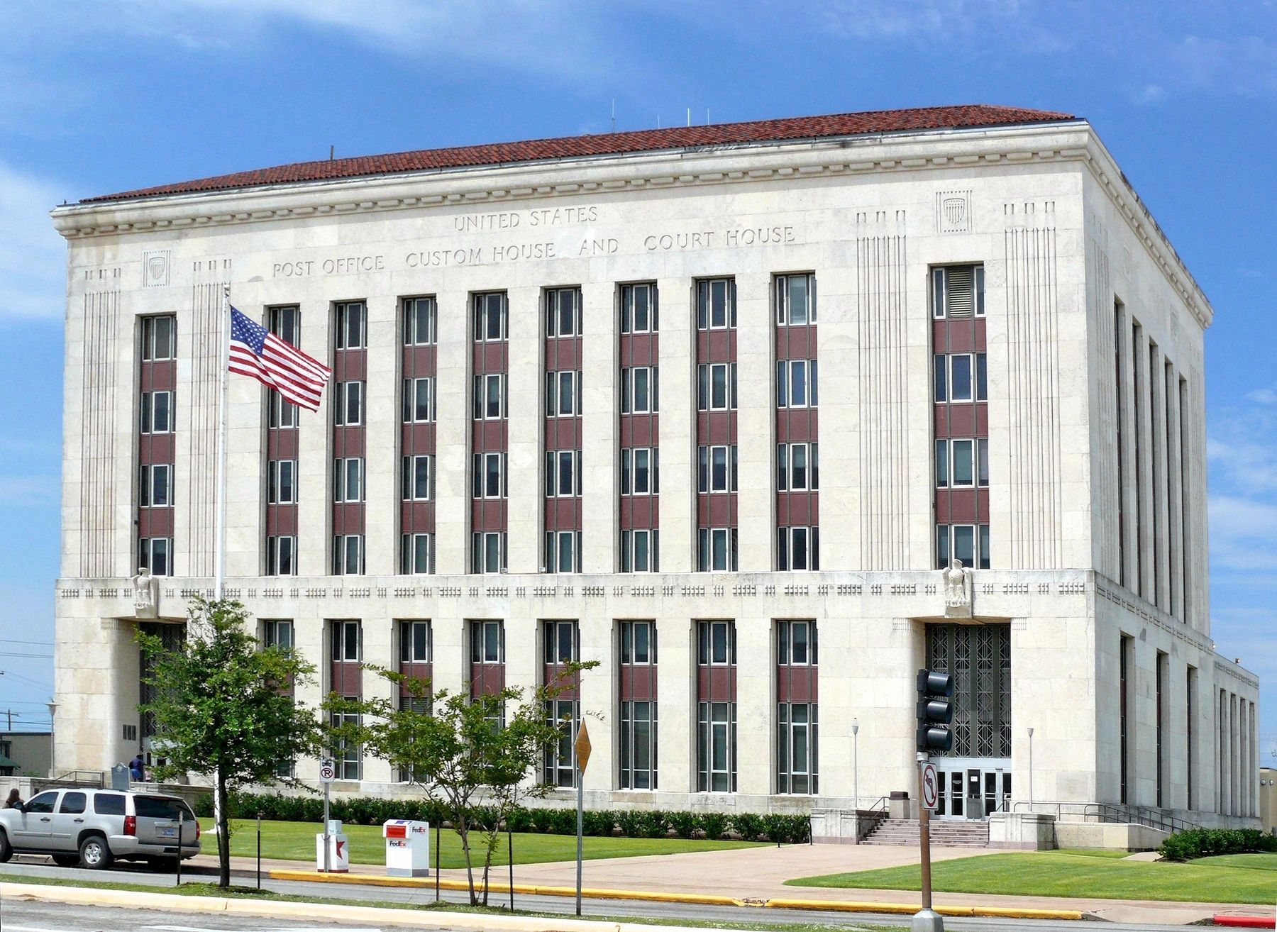
2. Galveston Office of the National Weather Service
The marker is to the far left above the vehicle.
Also see . . . This Building (not this marker) is on the National Register of Historical Places. This building is listed in the National Registry of Historic Places as the "Galveston US Post Office, Custom House and Courthouse." The list is alphabetical. (Submitted on June 11, 2012, by Jim Evans of Houston, Texas.)
Credits. This page was last revised on April 19, 2020. It was originally submitted on June 11, 2012, by Jim Evans of Houston, Texas. This page has been viewed 1,193 times since then and 52 times this year. Photos: 1, 2. submitted on April 19, 2020, by Jim Evans of Houston, Texas. • Bernard Fisher was the editor who published this page.
