Near Mauston in Juneau County, Wisconsin — The American Midwest (Great Lakes)
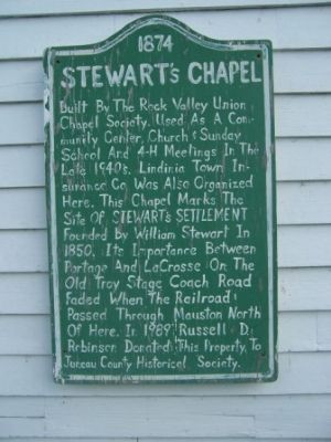
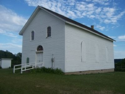
Stewart's Chapel
1874
Topics. This historical marker is listed in these topic lists: Churches & Religion • Settlements & Settlers. A significant historical year for this entry is 1850.
Location. 43° 44.261′ N, 90° 5.776′ W. Marker is near Mauston, Wisconsin, in Juneau County. Marker is on County Road O, 0.2 miles west of State Highway 58, on the left when traveling west. Touch for map. Marker is in this post office area: Mauston WI 53948, United States of America. Touch for directions.
Other nearby markers. At least 8 other markers are within 9 miles of this marker, measured as the crow flies. Orland S. Loomis (1893–1942) (approx. 4.2 miles away); The Iron Brigade (approx. 6.6 miles away); The Wisconsin River (approx. 6.6 miles away); The Sand Counties – Aldo Leopold Territory (approx. 7.4 miles away); Wisconsin Veterans Memorial Highway (approx. 7.4 miles away); Towns made from this? (approx. 8.4 miles away); Geology of the 400 Trail (approx. 8.6 miles away); Wonewoc History (approx. 8.6 miles away). Touch for a list and map of all markers in Mauston.
Credits. This page was last revised on June 16, 2016. It was originally submitted on June 15, 2012, by Gordon Govier of Fitchburg, Wisconsin. This page has been viewed 970 times since then and 46 times this year. Photos: 1, 2. submitted on June 15, 2012, by Gordon Govier of Fitchburg, Wisconsin. • Bernard Fisher was the editor who published this page.

