
Fashing in Atascosa County, Texas — The American South (West South Central)
Town of Fashing
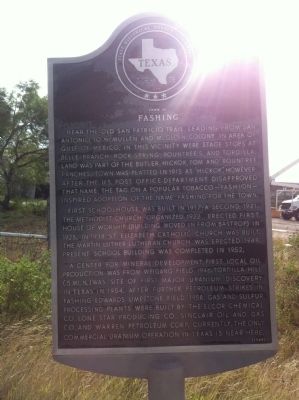
Photographed by John A Hensarling, June 20, 2012
1. Town of Fashing Marker
First schoolhouse was built in 1917; a second, 1921. The Methodist church, organized 1922, erected first house of worship (building moved in from Bastrop) in 1925. In 1934, St. Elizabeth Catholic Church was built. The Martin Luther Lutheran Church was erected 1948. Present school building was completed in 1952.
A center for mineral development. First local oil production was from Weigang Field, 1946. Tordilla Hill (5 mi. N.) was site of first major uranium discovery in Texas in 1954. After further petroleum strikes in Fashing Edwards Limestone Field, 1958, gas and sulfur processing plants were built by the
this page online
Erected 1968 by State Historical Survey Committee. (Marker Number 1576.)
Topics. This historical marker is listed in this topic list: Settlements & Settlers. A significant historical year for this entry is 1915.
Location. 28° 47.53′ N, 98° 8.4′ W. Marker is in Fashing, Texas, in Atascosa County. It is at the intersection of Farm to Market Road 2924 and Farm to Market Road 99, on the right when traveling south on Road 2924. Touch for map. Marker is in this post office area: Campbellton TX 78008, United States of America. Touch for directions.

Regionally, this marker is in the Hill Country and in the San Antonio Metropolitan Area. Globally, it is in North America, a Gulf of Mexico state, the Western Hemisphere, the Western World, and the Anglosphere. Historically, it finds itself in what was once New Spain, the Republic of Texas, and one of the Confederate States of America.
Other nearby markers. At least 7 other markers are within 19 miles of this marker,
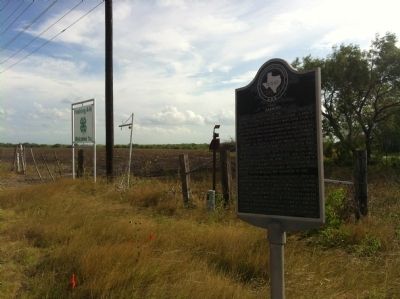
Photographed by John A Hensarling, June 20, 2012
2. Town of Fashing Marker
Credits. This page was last revised on June 16, 2016. It was originally submitted on June 20, 2012, by John A Hensarling of Campbellton, Texas. This page has been viewed 1,023 times since then and 23 times this year. Photos: 1, 2. submitted on June 20, 2012, by John A Hensarling of Campbellton, Texas. • Bernard Fisher was the editor who published this page.
