Black Mountain in Buncombe County, North Carolina — The American South (South Atlantic)
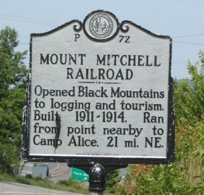
Mount Mitchell Railroad
Erected 1989 by Division of Archives and History. (Marker Number P-72.)
Topics and series. This historical marker is listed in this topic list: Railroads & Streetcars. In addition, it is included in the North Carolina Division of Archives and History series list.
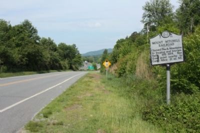
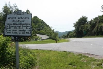
Location. 35° 37.171′ N, 82° 18.033′ W. Marker is in Black Mountain, North Carolina, in Buncombe County. Marker is at the intersection of Old U.S. 70 and Old Toll Road, on the right when traveling west on U.S. 70. Touch for map. Marker is in this post office area: Black Mountain NC 28711, United States of America. Touch for directions.
Other nearby markers. At least 8 other markers are within 2 miles of this marker, measured as the crow flies. Grey Eagle (approx. 1.1 miles away); Black Mountain (approx. 1.1 miles away); George Winslow Whittington (approx. 1.1 miles away); The Town of Black Mountain (approx. 1.1 miles away); Up to Black Mountain (approx. 1.1 miles away); The Center of It All (approx. 1.1 miles away); Slavery by Another Name (approx. 1.1 miles away); Comings and Goings (approx. 1.1 miles away). Touch for a list and map of all markers in Black Mountain.
Regarding Mount Mitchell Railroad. The story of the Mount Mitchell Railroad, like that of much of western North Carolina in the twentieth century, is one mixing equal parts of commerce and tourism. When the Black Mountains were opened to logging operations in the early 1900s, the first order of business was the construction of a railway to haul out the timber (most of it spruce pine). Work began in 1911, with the route surveyed by C. A. Dodd and work supervised by George Meyers and E. L. Sutton. The line ran across the Presbyterian grounds at Montreat and joined with Southern Railway just east of the town of Black Mountain. The other terminus, twenty-one miles northeast and 3,500 feet higher in elevation, was Camp Alice, located just one-half mile from the summit of Mount Mitchell. Work on the railroad was completed in 1914.
Many western North Carolinians opposed the deforestation of the Black Mountains, among them Governor Locke Craig, who led the move to establish Mount Mitchell State Park in 1915. This ushered in a new age of tourism with the rail line being opened to passenger traffic as early as July 1915. In 1923 the new owners of the railroad bed converted it into the “Mount Mitchell Motor Road,” a cinder-surfaced, one-way toll road to the top of the highest peak in the eastern United States. The route was so popular that a second toll road was built by competing entrepreneurs on the Yancey County
side of the Black Mountain range.
In 1939 that portion of the Blue Ridge Parkway between NC 80 and Black Mountain Gap was completed, thereby giving tourists toll-free access to Mount Mitchell. A section of the old railroad bed route was taken over by the state; the remainder has deteriorated.(North Carolina Dept. of Cultural Resources)
Also see . . . North Carolina Railroads - Mount Mitchell Railroad. Tourist trains ran from 1913 to 1918, when government pressure forced the end in favor of spruce lumber removal - which was needed by the massive airplane development during World War I. (Submitted on June 25, 2012, by Mike Stroud of Bluffton, South Carolina.)
Credits. This page was last revised on June 22, 2021. It was originally submitted on June 23, 2012, by Mike Stroud of Bluffton, South Carolina. This page has been viewed 1,084 times since then and 72 times this year. Photos: 1, 2, 3. submitted on June 24, 2012, by Mike Stroud of Bluffton, South Carolina.


