Stoney Creek in Hamilton, Ontario — Central Canada (North America)
Battle of Stoney Creek
[English Text]: Battle of Stoney Creek
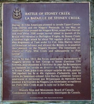
During 1813 the Americans planned to invade Upper Canada from Detroit and the Niagara Peninsula. In late May, an American force crossed the Niagara River, seized Fort George, and with about 3500 troops moved inland in pursuit of the British who retreated to Burlington Heights. At Stoney Creek, a surprise night attack by about 700 regulars of the 8th and 49th Regiments of Foot under Lt.-Col. John Harvey halted the American advance and allowed the British to re-establish their position on the Niagara frontier. The Americans retreated to Forty Mile Creek and subsequently to Fort George.
[French Text]: La Bataille de Stoney Creek
Vers la fin mai, 1813, des forces americaines traversèrent le Niagara, prirent le fort George et fortes d'environ 3500 hommes, pourchasserent a l'interieur du pays les Britanniques qui battaient en retraite en direction de Burlington Heights. A Stoney Creek, grace a une attaque surprise de nuit, quelque 700 reguliers des 8e et 49e regiments d'infanterie, sous les ordres du lieutenant-colonel John Harvey, arreterent l'avance americaine et permirent aux Britanniques de reprendre leur position a la frontiere du Niagara. Les Americains se replierent sur Forty Mile Creek et par la suite sur le fort George.
Erected by Historic Sites and Monuments Board of Canada.
Topics and series. This historical marker is listed in this topic list: War of 1812. In addition, it is included in the Canada, Historic Sites and Monuments Board series list. A significant historical year for this entry is 1813.
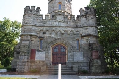
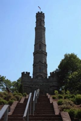
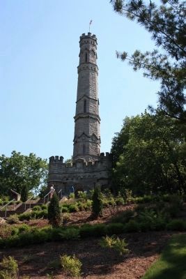
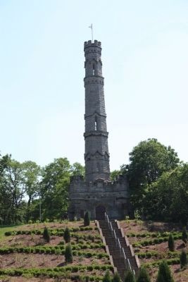
Location. 43° 13.008′ N, 79° 45.986′ W. Marker is in Stoney Creek, Ontario, in Hamilton. Marker can be reached from King Street West east of Centennial Parkway South. This historic marker is affixed to the north side of the Stoney Creek Memorial Monument, which towers over the ridge where the American army was encamped, and where the battle took place. Touch for map. Marker is in this post office area: Stoney Creek ON L8G, Canada. Touch for directions.
Other nearby markers. At least 8 other markers are within 3 kilometers of this marker, measured as the crow flies. Their Fame Liveth (here, next to this marker); a different marker also named Battle of Stoney Creek (about 90 meters away, measured in a direct line); Battlefield House (about 120 meters away); The Nash-Jackson House (about 150 meters away); The Battlefield of Stoney Creek (approx. 0.2 kilometers away); Billy Green Monument (approx. 0.3 kilometers away); Augustus Jones (C. 1757-1836) (approx. one kilometer away); Hamilton Aviation History (approx. 2.8 kilometers away). Touch for a list and map of all markers in Stoney Creek.
More about this marker. This historic marker
represents an extremely significant event in the history of the War of 1812, especially from the Canadian perspective of the conflict. The marker is affixed to a very impressive monument and the grounds that the monument is situated upon have some very nice landscaping. So all in all it is well worth the effort to see this historic marker and monument. That being said, it will require some walking to get to, you will not be able to reach it directly by car. Although it will not be an excessively long walk, it will still be a bit of a trek from the parking lot at the base of the escarpment to the monument on the ridge above the battlefield and because of that there will be a number of steps to climb. So be prepared, but I do believe that experiencing the historic marker, the monument, and the location are well worth the effort involved.
Also see . . .
1. Battle of Stoney Creek. This is a link to information provided by Wikipedia, the free encyclopedia. (Submitted on June 25, 2012, by Dale K. Benington of Toledo, Ohio.)
2. War of 1812: Battle of Stoney Creek. This is a link to information provided by About.com, a part of the New York Times Company. (Submitted on June 25, 2012, by Dale K. Benington of Toledo, Ohio.)
3. Battlefield House Museum & Park. Ontario Museum Association website entry (Submitted on January 9, 2023, by Larry Gertner of New York, New York.)
4. Battle of Stoney Creek National Historic Site of Canada
. This is a link to information from a website that is administered by Parks Canada. (Submitted on June 25, 2012, by Dale K. Benington of Toledo, Ohio.)
Credits. This page was last revised on January 9, 2023. It was originally submitted on June 25, 2012, by Dale K. Benington of Toledo, Ohio. This page has been viewed 953 times since then and 48 times this year. Photos: 1, 2, 3, 4, 5, 6. submitted on June 25, 2012, by Dale K. Benington of Toledo, Ohio.
