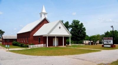
Promised Land in Greenwood County, South Carolina — The American South (South Atlantic)
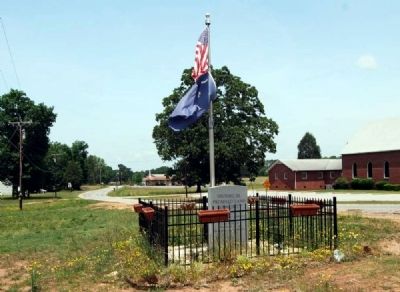
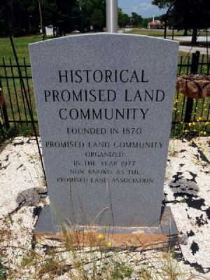
Historical Promised Land Community
Promised Land Community
Organized
in the Year 1977
Now Known as the
Promised Land Association
Topics. This historical marker is listed in this topic list: Settlements & Settlers. A significant historical year for this entry is 1870.
Location. 34° 7.794′ N, 82° 14.483′ W. Marker is in Promised Land, South Carolina, in Greenwood County. Marker is on McCormick Highway (State Highway 10) near New Zion Road, on the right when traveling south. Touch for map. Marker is in this post office area: Bradley SC 29819, United States of America. Touch for directions.
Other nearby markers. At least 10 other markers are within 7 miles of this marker, measured as the crow flies. Louis Booker Wright (approx. 4.8 miles away); Cedar Springs A.R.P. Church (approx. 4.9 miles away); Constance Pope Maxwell (approx. 5.1 miles away); Patrick H. Bradley (approx. 5.6 miles away); Bradley CCC Camp F-7 (approx. 5.7 miles away); In Memorium (approx. 6 miles away); Greenwood County Confederate Monument (approx. 6 miles away); To The People of Greenwood County (approx. 6.1 miles away); In God We Trust (approx. 6.1 miles away); Municipal Fountain (approx. 6.2 miles away).
Also see . . . Promised Land, South Carolina. Promised Land is a census-designated place (CDP) in Greenwood County, South Carolina, United States. (Submitted on June 25, 2012, by Brian Scott of Anderson, South Carolina.)
Credits. This page was last revised on June 16, 2016. It was originally submitted on June 25, 2012, by Brian Scott of Anderson, South Carolina. This page has been viewed 1,096 times since then and 59 times this year. Photos: 1, 2, 3, 4, 5. submitted on June 25, 2012, by Brian Scott of Anderson, South Carolina.
