Near Thorold in Niagara Region, Ontario — Central Canada (North America)
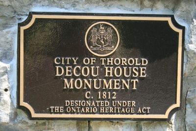
DeCou's Stone House
1812 - 1950
Inscription.
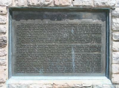
This house of Captain John DeCou (the name was variously spelled by his relatives and descendants and latterly as DeCew) was the Headquarters of the British outpost under Lieut. James Fitzgibbon to which came Laura Secord through the woods and swamps below the Niagara Escarpment from Queenston on June 24, 1813 to warn of the American advance. Thus warned, the small British force with its Indian allies captured, by bold strategy, at Beaverdams, the entire force with its commanding officer, Lieut. Col. Charles G. Boerstler. That action, "the fight in the beech woods," was a turning point of the war.
Capt. John DeCou, a militia officer since 1809, had been taken prisoner after the capture of Niagara and Ft. George on May 27, 1813. His wife and children lived here through the war. Their home was also a military post and supply point at various times. Cap. DeCou escaped from captivity in 1814 to serve until the end of the war. He was present at Lundy's Lane.
Born of English stock in Vermont in 1766, John DeCou came to Upper Canada as a young United Empire Loyalist and became a pioneer farmer, fruit grower, and industrialist. He married Catherine, daughter of Frederick Docksteter of Butler's Rangers in 1798. They had eleven children. He died in 1855 at DeCewsville in Haldimand, the second community of which he was the founder and which bore his name.
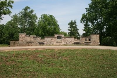
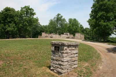
After the war he restored and developed this property and the area became the Hamlet of DeCew Town now DeCew Falls. He advocated and became a director of the first Welland Canal. When the route was changed, leaving his mills without water power, he became an opponent of the scheme. Because of the diversion of water from his mills John DeCou sold this place in 1834. The purchaser, David Griffiths, and his descendants occupied the house until 1942. It was the acquired with the surrounding property by the Hydro-Electric Power Commission of Ontario for the extension of the DeCew Falls Generating Station which originally had been created by the diversion, to the stream of John DeCou, of additional water from the third Welland Canal. In 1950, while unoccupied, it was destroyed by fire believed to have been of incendiary origin. It was preserved in its present state and this tablet erected in 1952 by the Hydro-Electric Power Commission of Ontario.
Erected 1952 by the Hydro-Electric Power Commission of Ontario.
Topics. This historical marker is listed in these topic lists: Industry & Commerce • War of 1812. A significant historical date for this entry is May 27, 1813.
Location. 43° 6.467′ N, 79° 15.016′ W. Marker is near Thorold, Ontario, in Niagara Region. Marker
is on DeCew Road west of Merrittville Highway (Ontario Highway 50), on the right when traveling west. Touch for map. Marker is at or near this postal address: 2350 DeCew Road, Thorold ON L0S 1E6, Canada. Touch for directions.
Other nearby markers. At least 8 other markers are within 5 kilometers of this marker, measured as the crow flies. In Memory of John Bean, Ph.D., M.D. (approx. 4.3 kilometers away); Beaver Dams (approx. 4.3 kilometers away); In Memory of Unknown American Soldiers (approx. 4.3 kilometers away); Arthur S. Whelan (approx. 4.3 kilometers away); Laura Ingersoll Secord (approx. 4.3 kilometers away); The Founding of Thorold (approx. 4.3 kilometers away); Old Thorold Firehall (approx. 4.4 kilometers away); Lock 24 - First Welland Canal (approx. 4.5 kilometers away). Touch for a list and map of all markers in Thorold.
More about this marker. In his book, "Guidebook to the Historic Sites of the War of 1812," Gilbert Collins states, "Unfortunately De Cew's House, which had stood for over one hundred years, has been destroyed. In 1950 the unoccupied house was burned down under mysterious circumstances. The above-ground remains are located on De Cew Road, not far from the De Cew Falls, in the Regional Municipality of Niagara." (page 131)
Related markers. Click here for a list of markers that are related to this marker. To better understand the relationship, study each marker in the order shown.
Also see . . .
Decew (deCou) House. This is a link to information provided by Exploring Niagara. (Submitted on June 26, 2012, by Dale K. Benington of Toledo, Ohio.)
Credits. This page was last revised on October 29, 2020. It was originally submitted on June 26, 2012, by Dale K. Benington of Toledo, Ohio. This page has been viewed 647 times since then and 26 times this year. Photos: 1, 2, 3, 4, 5, 6, 7. submitted on June 27, 2012, by Dale K. Benington of Toledo, Ohio.
