Vanalinn in Tallinn, Harju maakond, Estonia — Northern Europe (the Baltics States)
Toompea Loss
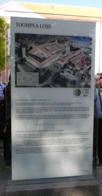
[Toompea Castle]
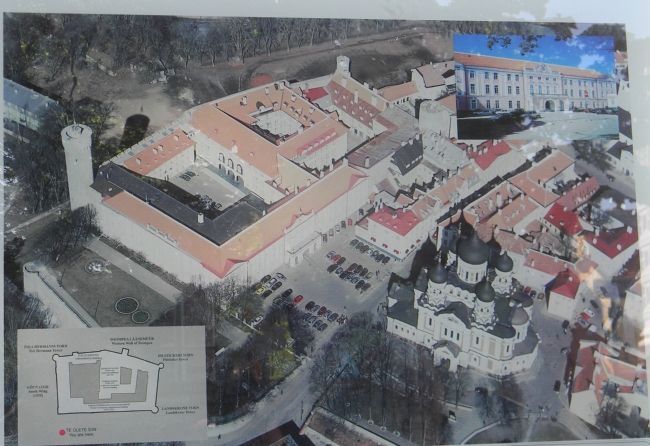
Aerial photo of the castle and surroundings
Text in Estonian : …
Text in English:
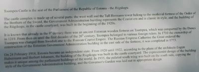
Toompea Castle is the seat of the Parliament of the Republic of Estonia – the Riigikogu
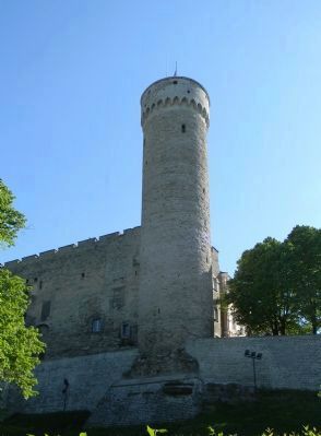
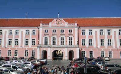
The castle complex is made up of several parts: the west wall and the Tall Hermann tower belongs to the medieval fortress of the Order of the Brothers of the Sword, the Government Administration building represents the Czarist era and is classic in style, and the building of the Riigikogu, in the castle courtyard, was built in the beginning of the 1920s.
It is known that already in the 9th century there was an ancient Estonian wooden fortress on Toompea, which was conquered by the Danes in 1219. From then on until the first decades of the 20th century, Toompea belonged to various foreign rulers. In 1710 the ownership of Toompea was changed from Swedish one to the Russian Czarist Empire. The Russian Empress Catherine the Great ordered the construction of the Estonian Government Administration building in the east side of the fortress; it was completed in 1773.
On 24 February 1918, Estonia became an independent state. From 1920 until 1922, according to the plans of the architects Eugen Habermann and Herbert Johanson, the building of the Riigikogu was built in the castle courtyard. The expressionist design of the building makes it unique among the parliament buildings of the world. In 1935, the palatial south wing was built on the south side, copying the style of the Government Administration building, and the Governor’s Garden was laid out in appropriate design.
Erected by City of Tallinn.
Topics. This historical marker is listed in these topic lists: Churches & Religion • Forts and Castles • Government & Politics. A significant historical date for this entry is February 24, 1918.
Location. 59° 26.085′ N, 24° 44.348′ E. Marker is in Vanalinn, Harju maakond, in Tallinn. Marker is at the intersection of Lossi Plats/Toompea and Komandandi Tee on Lossi Plats/Toompea. Touch for map. Marker is in this post office area: Vanalinn, Harju maakond 10137, Estonia. Touch for directions.
Other nearby markers. At least 8 other markers are within walking distance of this marker. Residence of Konstantin Päts (approx. 0.3 kilometers away); The Historic Centre (Old Town) of Tallinn (approx. 0.4 kilometers away); Tallinn Town Hall - Anno 1404 (approx. 0.4 kilometers away); Suurgildi Hoone (approx. half a kilometer away); Mustpeade Maja (approx. 0.6 kilometers away); British Royal Navy in the Estonian War of Independence (approx. one kilometer away); Polish Submarine "ORZEŁ" - September 1939 (approx. one kilometer away); Mälestusmärk “Katkenud Liin” / “Broken Line” (approx. 1.1 kilometers away). Touch for a list and map of all markers in Vanalinn.
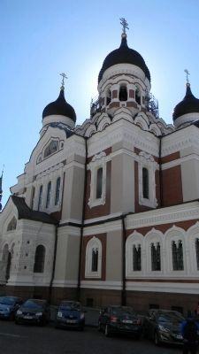
Additional keywords. Alexander Nevsky Cathedral Toompea Loss
Credits. This page was last revised on March 8, 2023. It was originally submitted on July 1, 2012, by Richard E. Miller of Oxon Hill, Maryland. This page has been viewed 755 times since then and 14 times this year. Photos: 1. submitted on July 1, 2012, by Richard E. Miller of Oxon Hill, Maryland. 2, 3, 4, 5, 6. submitted on July 2, 2012, by Richard E. Miller of Oxon Hill, Maryland. • Bill Pfingsten was the editor who published this page.
