El Dorado Springs in Cedar County, Missouri — The American Midwest (Upper Plains)
Former School Districts in El Dorado Springs R-2
Inscription.
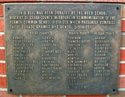
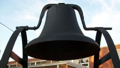
This bell has been donated by the Rock School District of Cedar County Missouri in commemoration of the former Common School Districts which presently comprise the El Dorado Springs R-2 School District.
Cedar County
Barnes Cedar Springs Cherry Valley Cline Hill Clintonville Coal Hill Concord El Dorado Springs Flat Rock Forest Grove Green Ridge Gordon Hazel Dell Jackson Johnson Liberty Hall Love Pleasant Ridge Rock Sandridge Union Hall Vandenburg Walnut Grove White Hall Wright Nine Wonders
Vernon County
Dederick Diamond Grove Flycreek Green Top Keck Mobley Montevallo New Harmony Oak Grove Oak Ridge Pleasant Valley Round Prairie Science Hill Union Virgil City Willow Grove
St. Clair County
Ararat Blackjack Blue Ridge Forest Grove Glendale Graham Greenwood Mt. Olive Riverview Snyder Stony Point Union Point
Erected by El Dorado Springs R-2 School District.
Topics. This historical marker is listed in these topic lists: Education • Settlements & Settlers.
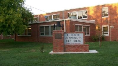
Location. 37° 52.1′ N, 94° 1.149′ W. Marker is in El Dorado Springs, Missouri, in Cedar County. Marker is at the intersection of Grand Avenue and Pine Street, on the left when traveling south on Grand Avenue. Marker and bell are near the entrance to El Dorado Springs High School. Touch for map. Marker is at or near this postal address: 901 South Grand Avenue, El Dorado Springs MO 64744, United States of America. Touch for directions.
Other nearby markers. At least 8 other markers are within 2 miles of this marker, measured as the crow flies. Missouri Bicentennial Wagon (approx. Ό mile away); Grindstone Wash Basin (approx. 0.6 miles away); City Park Dedication (approx. 0.6 miles away); El Dorado Spring (approx. 0.6 miles away); Roy Bandy and Eddy Wilson (approx. 0.6 miles away); Nathaniel H. and Waldo P. Cruce (approx. 0.6 miles away); Prairie (approx. 0.6 miles away); Veterans Memorial (approx. 1.2 miles away). Touch for a list and map of all markers in El Dorado Springs.
Credits. This page was last revised on June 16, 2016. It was originally submitted on July 12, 2012, by William Fischer, Jr. of Scranton, Pennsylvania. This page has been viewed 617 times since then and 27 times this year. Photos: 1, 2, 3. submitted on July 12, 2012, by William Fischer, Jr. of Scranton, Pennsylvania.


