Near Redding in Shasta County, California — The American West (Pacific Coastal)
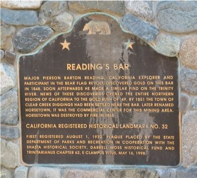
Reading's Bar
Erected 1998 by First Registered August 1, 1932. Plaque placed by the State Department of Parks and Recreation in cooperation with the Shasta Historical Society, Darrell Moss Historical Fund and Trinitarianus Chapter 62, E Clampus Vitus. (Marker Number 32.)
Topics and series. This historical marker is listed in these topic lists: Landmarks • Settlements & Settlers. In addition, it is included in the California Historical Landmarks, and the E Clampus Vitus series lists. A significant historical year for this entry is 1848.
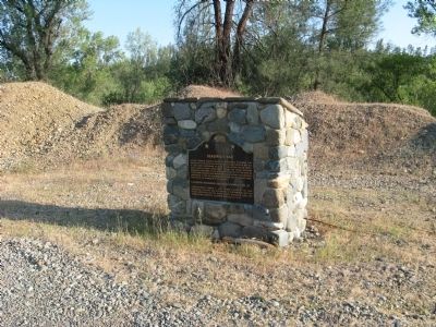
Location. 40° 29.679′ N, 122° 29.835′ W. Marker is near Redding, California, in Shasta County. Marker is on Clear Creek Road, on the left when traveling west. Marker is next to the bridge crossing Clear Creek. Touch for map. Marker is in this post office area: Redding CA 96001, United States of America. Touch for directions.
Other nearby markers. At least 8 other markers are within 3 miles of this marker, measured as the crow flies. Piety Hill (approx. 1.4 miles away); Native Americans in the Clear Creek Watershed (approx. 1.6 miles away); Gold Fever in Clear Creek (approx. 1.6 miles away); Historic Igo Inn (approx. 2˝ miles away); U.S. Army Special Forces Memorial (approx. 2.6 miles away); Submariners Memorial (approx. 2.7 miles away); Military Order of the Purple Heart Memorial (approx. 2.7 miles away); Northern California Veterans Memorials (approx. 2.7 miles away). Touch for a list and map of all markers in Redding.
Related marker. Click here for another marker that is related to this marker. The Readings Bar marker at the Trinity River.
Credits. This page was last revised on June 16, 2016. It was originally submitted on August 15, 2008, by Syd Whittle of Mesa, Arizona. This page has been viewed 1,381 times since then and 50 times this year. Last updated on July 24, 2012, by Michael Kindig of Elk Grove, California. Photos: 1, 2. submitted on August 15, 2008, by Syd Whittle of Mesa, Arizona.

