Shasta in Shasta County, California — The American West (Pacific Coastal)
Shasta
Photographed by Karen Key, May 25, 2007
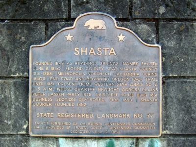
1. Shasta Marker
Founded 1849 as Reading's Springs. Named Shasta June 8, 1850. Second county seat Shasta County 1851-1888. Metropolis Northern California during 1850's. End road and beginning Oregon Pack Trail until 1861. Present home Western Star Lodge No. 2. F. & A.M., whose charter brought across plains Peter Lassen Party 1848. Shurtleff House built 1851. Business section destroyed, fire 1853. Shasta Courier founded 1852.
State Registered Landmark No. 77
Tablet furnished by California Centennials Commission. Base provided by Shasta County Centennial Committee
Dedicated June 12, 1950
Erected 1950. (Marker Number 77.)
Topics and series. This historical marker is listed in this topic list: Settlements & Settlers. In addition, it is included in the California Historical Landmarks series list. A significant historical date for this entry is June 8, 1943.
Location. 40° 35.94′ N, 122° 29.535′ W. Marker is in Shasta, California, in Shasta County. It is at the intersection of Highway 299 and High Street, on the left when traveling west on Highway 299. Touch for map. Marker is in this post office area: Shasta CA 96087, United States of
this page online

Regionally, this marker is in California’s Sacramento Valley, specifically in the Central Valley, and in the Shasta Cascade. It is also on the American Pacific Coast. Globally, it is in North America, in the Cascade Range, on the Ring of Fire, on the Pacific Rim, in the Western Hemisphere, in the Western World, and in the Anglosphere. Historically, it finds itself in what was once New Spain and also Mexico’s Alta California.
Other nearby markers. At least 8 other markers are within walking distance of this marker: Shasta County Court House (a few steps from this marker); “Stage Drivers’ Plaque” (within shouting distance of this marker); Gallows (within shouting distance of this marker); Survivors of the Gold Rush (within shouting distance of this marker); Noble’s Trail (within shouting distance of this marker); Western Star Lodge No. 2 (about 400 feet away, measured in a direct line); a different marker also named Western Star Lodge No. 2 (about 400 feet away); The Coyle-Foster Barn in its Heyday (about 400 feet away). Touch for a list and map of all markers in Shasta.
Also see . . .
1. Shasta State Historic Park.
Photographed by Karen Key, May 25, 2007
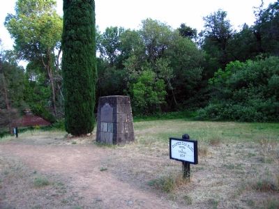
2. Shasta Marker
2. Shasta County, California. Wikipedia entry (Submitted on June 17, 2007, by Karen Key of Sacramento, California.)
Photographed by Jeff Leichsenring, July 13, 2024
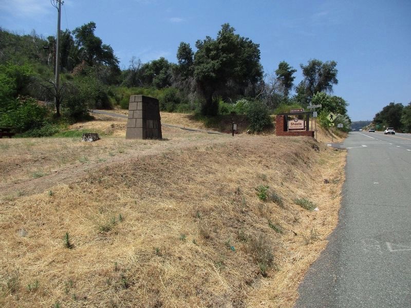
3. Shasta Marker
Credits. This page was last revised on July 23, 2024. It was originally submitted on June 17, 2007, by Karen Key of Sacramento, California. This page has been viewed 1,784 times since then and 33 times this year. Last updated on July 25, 2012, by Michael Kindig of Elk Grove, California. Photos: 1, 2. submitted on June 17, 2007, by Karen Key of Sacramento, California. 3. submitted on July 17, 2024, by Jeff Leichsenring of Garland, Texas. • Syd Whittle was the editor who published this page.
