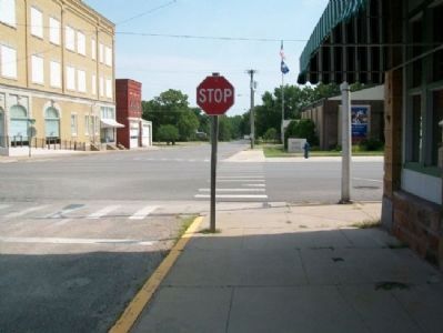
Caney in Montgomery County, Kansas — The American Midwest (Upper Plains)
Bell's Trading Post and Village Water Well
1869 - 1870
Inscription.
Location of Dr. J. W. Bell's Trading Post and Village Water Well, hand dug by John Luppy. Also, original Caney Survey Point and Marker.
Topics. This historical marker is listed in these topic lists: Charity & Public Work • Exploration • Industry & Commerce.
Location. 37° 0.704′ N, 95° 56.255′ W. Marker is in Caney, Kansas, in Montgomery County. Marker is at the intersection of 4th Avenue and State Street, on the right when traveling west on 4th Avenue. Touch for map. Marker is at or near this postal address: 410 West 4th Street, Caney KS 67333, United States of America. Touch for directions.
Other nearby markers. At least 8 other markers are within walking distance of this marker. Caney School District No. 34 (within shouting distance of this marker); Caney Memorial Street (about 300 feet away, measured in a direct line); World War Memorial (approx. 0.4 miles away); George H. Wark 1878 - 1974 (approx. 0.4 miles away); Caney High School Stadium (approx. 0.4 miles away); Black Dog Trail Campsite (approx. 0.4 miles away); “Walking Stick” Cannon (approx. half a mile away); Caney War Memorial (approx. half a mile away). Touch for a list and map of all markers in Caney.
More about this marker. The marker was moved from the center of the intersection when it was repaved.
Also see . . . Caney Valley Historical Society. Museum website homepage (Submitted on July 25, 2012, by William Fischer, Jr. of Scranton, Pennsylvania.)
Credits. This page was last revised on January 23, 2022. It was originally submitted on July 25, 2012, by William Fischer, Jr. of Scranton, Pennsylvania. This page has been viewed 529 times since then and 19 times this year. Photos: 1, 2, 3. submitted on July 25, 2012, by William Fischer, Jr. of Scranton, Pennsylvania.


