Camas in Clark County, Washington — The American West (Northwest)
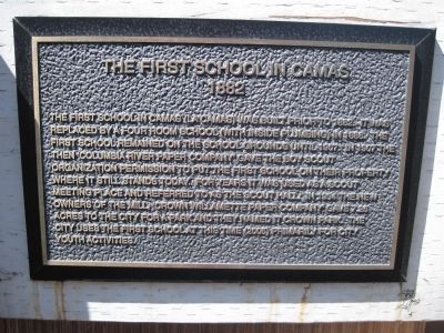
The First School in Camas
1882
Photographed by Rachel Aschmann, July 29, 2012
1. The First School in Camas Marker
Topics. This historical marker is listed in these topic lists: Education • Notable Buildings. A significant historical year for this entry is 1882.
Location. 45° 35.437′ N, 122° 24.399′ W. Marker is in Camas, Washington, in Clark County. It can be reached from NE 15th Avenue near NE Dallas Street when traveling east. The marker and schoolhouse are located at Crown Park. Touch for map. Marker is in this post office area: Camas WA 98607, United States of America. Touch for directions.

Regionally,
this page online
Other nearby markers. At least 8 other markers are within 5 miles of this marker, measured as the crow flies: Camas-Washougal War Memorial (approx. 0.3 miles away); Crown Zellerbach Employee World War II Memorial (approx. 0.3 miles away); Stocking the Pantry (approx. 2.7 miles away); William R. Broughton R.N. (approx. 2.8 miles away); Captain William Clark Park (approx. 3.4 miles away); Sandy River Bridge (approx. 3.9 miles away in Oregon); Tad's Chicken 'N Dumplin's (approx. 4.2 miles away in Oregon); Fishers (approx. 4.6 miles away). Touch for a list and map of all markers in Camas.
Photographed by Rachel Aschmann, August 8, 2012
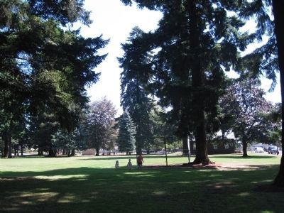
2. The First School in Camas Marker
Looking through Crown Park at the old school.
Photographed by Rachel Aschmann, July 29, 2012
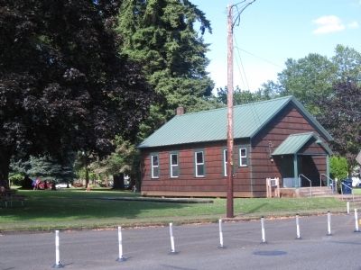
3. The First School in Camas Marker
Credits. This page was last revised on June 16, 2016. It was originally submitted on July 29, 2012, by Rachel Aschmann of Camas, Washington. This page has been viewed 1,567 times since then and 102 times this year. Photos: 1. submitted on July 29, 2012, by Rachel Aschmann of Camas, Washington. 2. submitted on August 9, 2012, by Rachel Aschmann of Camas, Washington. 3. submitted on July 29, 2012, by Rachel Aschmann of Camas, Washington. • Syd Whittle was the editor who published this page.
