Near Shingletown in Shasta County, California — The American West (Pacific Coastal)
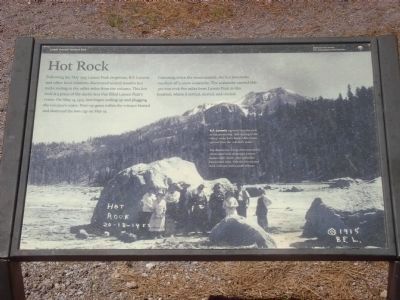
Hot Rock

Photographed By Barry Swackhamer, July 12, 2012
1. Hot Rock Marker
[Photo caption:]
B.F. Loomis reported that the rock in this photo was “still sizzling in the water” some forty hours after it was ejected from the volcano’s crater.
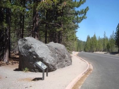
The destructive forces that moved this cabin-size rock destroyed a three-square-mile swath, now called the Devastated Area. Visit the Devastated Area Trail two miles south of here.
Careening down the mountainside, hot lava rocks touched off a snow avalanche. The avalanche carried this 300-ton rock five miles from Lassen Peak to this location, where it settled, sizzled, and cooled.
Erected by Lassen Volcanic National Park, Department of the Interior, National Park Service.
Topics. This historical marker is listed in this topic list: Disasters. A significant historical month for this entry is May 1915.
Location. 40° 31.07′ N, 121° 28.087′ W. Marker is near Shingletown, California, in Shasta County. Marker is on Lassen Peak Highway (California Route 89), on the right when traveling south. This marker is in Lassen Volcanic National Park and is Auto Tour Stop #12. Touch for map. Marker is in this post office area: Shingletown CA 96088, United States of America. Touch for directions.
Other nearby markers. At least 8 other markers are within 6 miles of this marker, measured as the crow flies. A Night to Remember / Three Days Later (approx. ¼ mile away); A Scenic Boulevard (approx. 3½ miles away); Pluck and Carry (approx. 4.1 miles away); Nobles' Emigrant Trail (approx. 4.4 miles away); Mt. Lassen/The Noble Pass/The Park Highway (approx. 4.4 miles away); Bumpass’s Hell (approx. 4½ miles away); Loomis Legacy (approx. 5.1 miles away); Stephen Tyng Mather (approx. 5.2 miles away). Touch for a list and map of all markers in Shingletown.
Also see . . . Eruptions of Lassen Peak, California, 1914 to 1917 - USGS. On May 22, 1915, an explosive eruption at Lassen Peak, California, the southernmost active volcano in the Cascade Range, devastated nearby areas and rained volcanic ash as far away as 200 miles to the east. (Submitted on August 6, 2012, by Barry Swackhamer of Brentwood, California.)
Credits. This page was last revised on June 16, 2016. It was originally submitted on August 6, 2012, by Barry Swackhamer of Brentwood, California. This page has been viewed 781 times since then and 72 times this year. Photos: 1, 2. submitted on August 6, 2012, by Barry Swackhamer of Brentwood, California. • Syd Whittle was the editor who published this page.
