Iphofen in Kitzingen, Bavaria, Germany — Central Europe
The Owls' Tower
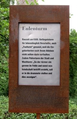
Eulenturm
Photographed by Andrew Ruppenstein, July 14, 2012
1. The Owls' Tower Marker

Bauzeit um 1500. Gefängnisturm für lebenlänglich Verurteilte, auch „Faulturm” genannt, weil die eingekerkerten nach ihrem Ableben nicht selten darin verfaulten. Zudem Pulverturm der Stadt und Wachturm: „So der türmer ein gerenn im Felde und sonst was feindschaft betrifft ersieht, soll er in die drummelte sto ßen und dies anzeigen”.
Built around 1500. A prison tower for those sentenced to life imprisonment. Also called the "Rotting Tower" because prisoners were left to rot after their expiration. It was said of this tower, as well as the city's powder- and watch-towers: "Should the watchman make his rounds and encounter some hostility, he need only to point to these towers".
Topics. This historical marker is listed in this topic list: Forts and Castles. A significant historical year for this entry is 1500.
Location. 49° 42.14′ N, 10° 15.798′ E. Marker is in Iphofen, Bayern (Bavaria), in Kitzingen. It is on Birkingerstrasse 0.1 kilometers west of Einersheimerstrasse. Touch for map. Marker is in this post office area: Iphofen BY 97346, Germany. Touch for directions.

Regionally, this marker is in German Franconia. Globally, it is in Europe, the European Union, Atlantic Europe, Central Europe, the Schengen Area, Western Europe, and the Western World. Historically, it finds itself in what was once the Holy Roman Empire and also the former West Germany.
Other nearby markers. At least 8 other markers are within 8 kilometers of this marker, measured as the crow flies: Ilmbacher Hof (about 120 meters away, measured in a direct line); Einersheimer Gate (about 120 meters away); Tithe Tower (about 180 meters away); Ebracher House (approx. 0.3 kilometers away); Iphofen City Hall (approx. 0.3 kilometers away); Mainbernheimer Gate
this page online
More about this marker. The marker is mounted chest-height on a pole along the greenbelt pathway that follows the outside edge of the moat along the city's walls. There is a parking lot nearby close to the intersection of Einersheimerstrasse and Birkingerstrasse. This view of the tower, from just outside the city walls, may be the closest approach to the tower, as the inside approach to the tower is blocked by a number of houses built up against the city walls. Hence the location of this marker, somewhat removed from its subject.
Additional keywords. jail prison

Photographed by Andrew Ruppenstein, July 14, 2012
2. The Owls' Tower and Marker - wide view

Photographed by Andrew Ruppenstein, July 14, 2012
3. The Owls' Tower, as seen from the Einersheimer Gatehouse
Credits. This page was last revised on January 7, 2024. It was originally submitted on August 11, 2012, by Andrew Ruppenstein of Lamorinda, California. This page has been viewed 573 times since then and 16 times this year. Photos: 1, 2, 3. submitted on August 11, 2012, by Andrew Ruppenstein of Lamorinda, California. • Bill Pfingsten was the editor who published this page.
