Near Shingletown in Shasta County, California — The American West (Pacific Coastal)
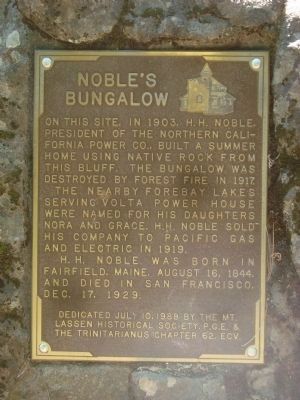
Noble’s Bungalow
The nearby forebay lakes serving Volta Power House were named for his daughters Nora and Grace. H.H. Noble sold his company to Pacific Gas and Electric in 1919.
H.H. Noble was born in Fairfield , Maine, August 16, 1844, and died in San Francisco Dec. 17, 1929.
Erected 1988 by Mt. Lassen Historical Society, P.G, & E, & E Clampus Vitus, Trinitarianus Chapter 62.
Topics and series. This historical marker is listed in these topic lists: Industry & Commerce • Notable Buildings. In addition, it is included in the E Clampus Vitus series list. A significant historical date for this entry is December 17, 2012.
Location. 40° 28.532′ N, 121° 51.717′ W. Marker is near Shingletown, California, in Shasta County. Marker can be reached from Alward Way. Touch for map. Marker is in this post office area: Shingletown CA 96088, United States of America. Touch for directions.
Other nearby markers. At least 8 other markers are within 6 miles of this marker, measured as the crow flies. Nobles Emigrant Trail (approx. 1.7 miles away); Shingletown Store (approx. 1.8 miles away); Nobles Trail - Shingletown (approx. 1.9 miles away); Manton Store (approx. 2.9 miles away); Hennessy House (approx. 2.9 miles away); Manton Schoolhouse (approx. 3 miles away); Nobles Trail – Junction (approx. 4.2 miles away); Charlie’s Place (approx. 5.3 miles away). Touch for a list and map of all markers in Shingletown.
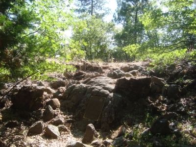
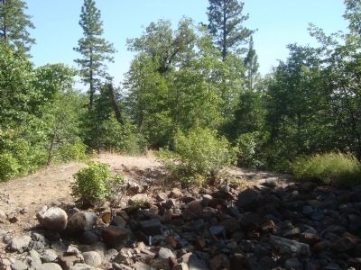
More about this marker. Directions to Noble's Bungalow Marker: From Shingletown go east on Highway 44. Turn right on Alward Road (Way). Follow the 'main', gravel road toward Nora and Grace Lakes (named after Noble's daughters). This involves making a left turn, followed by a couple of right turns. The road will change names a couple of times, but they are mostly un-signed. Proceed through the Nora Lake Picnic Grounds, then make a hard left turn onto a dirt road. Proceed around Nora Lake then about 1/4 mile to the end of the road. The pile of rubble at the end of the road is what is left of Noble's Bungalow.
Credits. This page was last revised on June 16, 2016. It was originally submitted on August 7, 2012, by Barry Swackhamer of Brentwood, California. This page has been viewed 784 times since then and 36 times this year. Last updated on August 21, 2012, by Barry Swackhamer of Brentwood, California. Photos: 1, 2, 3. submitted on August 7, 2012, by Barry Swackhamer of Brentwood, California. • Syd Whittle was the editor who published this page.


