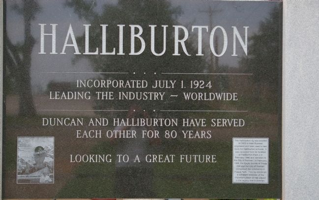
Halliburton
Incorporated July 1, 1924
Leading the Industry - Worldwide
Duncan and Halliburton Have Served
Each Other For 80 Years
Looking to a Great Future
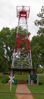
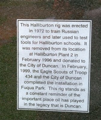
Small Inset: This Halliburton rig was erected in 1972 to train Russian engineers and later used to test tools for Halliburton schools. It was removed from its location at Halliburton Plant 2 in February 1996 and donated to the City of Duncan. In February, 1999, the Eagle Scouts of Troop 434 and the City of Duncan completed the installation in Fuqua Park. This rig stands as a constant reminder of the important place oil has played in the legacy that is Duncan.
Erected 1999 by Duncan Boy Scout Troop 434 and City of Duncan.
Topics. This historical marker is listed in this topic list: Industry & Commerce. A significant historical month for this entry is February 1996.
Location. 34° 30.378′ N, 97° 57.954′ W. Marker is in Duncan, Oklahoma, in Stephens County. Marker is on U.S. 81, 0 miles north of W. Oak Ave., on the left when traveling south. This memorial is actually a picnic pavilion with the oil rig on top. It is at the far south end of Fuqua Park, opposite the Rock Island Museum and Engine 905. Touch for map. Marker is in this post office area: Duncan OK 73533, United States of America. Touch for directions.
Other nearby markers. At least 8 other markers are within
More about this marker. The park with the odd name is the namesake of Duncan's Fuqua family, prominent in Duncan business. The family's most prominent member was probably Herbert Breedlove "Babe" Fuqua, well known in Southwest Oklahoma, the University of Oklahoma, and Ft. Worth, Texas as a businessman and politician.
Regarding Halliburton. Although Halliburton has moved its headquarters from Duncan, it is still a major presence both in business and civic affairs in the town. This is not the only monument in town related to the company. Memorial Park, just up the street on US 81, has a large monument dedicated to Erle P. Halliburton, the company's founder. He started the company's predecessor in 1919 when he pioneered and patented a method for casing producing wells in concrete which is still used today.
Many outsiders would castigate Halliburton for moving its headquarters to Houston, this monument is an indication of how local citizens feel.
Additional keywords. drilling rig, oil rig, oil industry
Credits. This page was last revised on June 16, 2016. It was originally submitted on August 24, 2012, by M. Blakelylaw of Southeast, Oklahoma. This page has been viewed 540 times since then and 30 times this year. Photos: 1, 2, 3, 4. submitted on August 24, 2012, by M. Blakelylaw of Southeast, Oklahoma. • Bill Pfingsten was the editor who published this page.


