
Fort Smith in Sebastian County, Arkansas — The American South (West South Central)
Barracks, Courthouse, Jail
Fort Smith National Historic Site
| — | National Park Service, U.S. Department of the Interior | — |
Photographed by Denise Boose, July 13, 2012
1. Barracks, Courthouse, Jail Marker
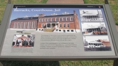
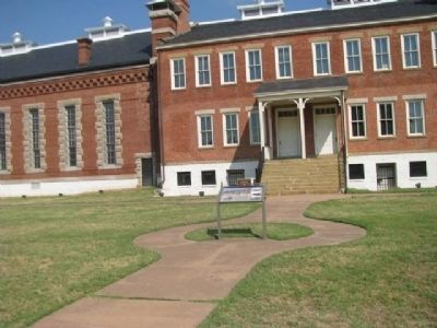
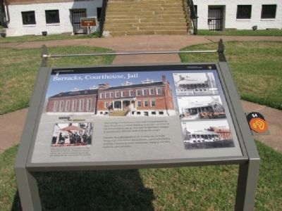
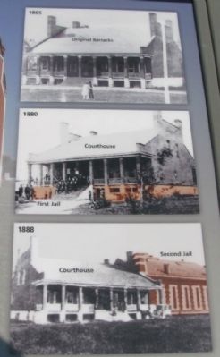
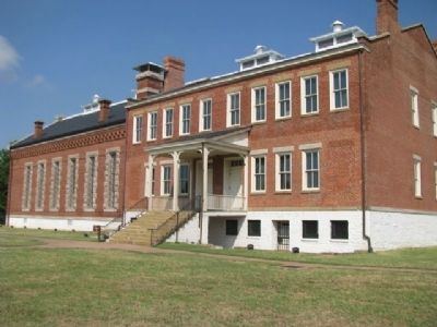
The building in front of you is very much as it appeared in the 1890s. First built as a military barracks, it was later converted for use as a courthouse and jail. Over time its appearance changed to accommodate different needs of the people using it.
Compare these photographs to the building you see today. Notice clues of its former appearance by examining bricked-in-windows, remnants of porch foundations, changing rooflines, and brick color variations.
Erected by National Park Service, U.S. Department of the Interior.
Topics. This historical marker is listed in this topic list: Government & Politics.
Location. 35° 23.293′ N, 94° 25.763′ W. Marker is in Fort Smith, Arkansas, in Sebastian County. It is on Parker Avenue, on the left when traveling north. Touch for map. Marker is at or near this postal address: 301 Parker Avenue, Fort Smith AR 72901, United States of America. Touch for directions.

Regionally, this marker is in the Arkansas River Valley, in the Cherokee Heritage Region, and in Osage Territory. It is also in the American South and specifically
this page online
Other nearby markers. At least 8 other markers are within walking distance of this marker: Clues from the Past (a few steps from this marker); Second Fort Smith Memorial (within shouting distance of this marker); Welcome to Fort Smith (within shouting distance of this marker); Meeting of Nations (within shouting distance of this marker); Old Federal Building (within shouting distance of this marker); Confederates Occupy The Fort (within shouting distance of this marker); Confederate Occupation of Fort Smith / Union Occupation of Fort Smith (within shouting distance of this marker); The Flagstaff (within shouting distance of this marker). Touch for a list and map of all markers in Fort Smith.
Photographed by Denise Boose, July 13, 2012
2. Barracks, Courthouse, Jail Marker
Photographed by Denise Boose, July 13, 2012
3. Barracks, Courthouse, Jail Marker
Photographed by Denise Boose, July 13, 2012
4. Barracks, Courthouse, Jail Marker
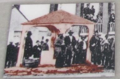
Under the circular patch of grass before you is the site of a well. Sheltered by a small gazebo, this well supplied water until the courthouse and the new jail were added to the city water system in the late 1880s.
Photographed by Denise Boose, July 13, 2012
5. Barracks, Courthouse, Jail Marker
Compare these photographs to the building you see today. Notice clues of its former appearance by examining bricked-in-windows, remnants of porch foundations, changing rooflines, and brick color variations.
Photographed by Denise Boose, July 13, 2012
6. Barracks, Courthouse, Jail
Credits. This page was last revised on June 12, 2020. It was originally submitted on September 2, 2012, by Denise Boose of Tehachapi, California. This page has been viewed 841 times since then and 22 times this year. Photos: 1, 2, 3, 4, 5, 6. submitted on September 2, 2012, by Denise Boose of Tehachapi, California. • Craig Swain was the editor who published this page.
