Near Springstead in Iron County, Wisconsin — The American Midwest (Great Lakes)
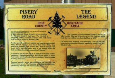
Pinery Road - The Legend
Iron County Heritage Area
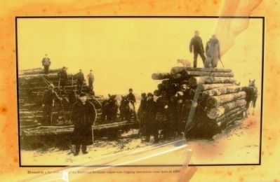
In 1904, a tornado ripped through this area, toppling the last great stands of virgin pine. The “windfall” in salvageable timber attracted brothers John and David Emerson to the vicinity of Bearskull Lake.
Hauling sawmill machinery, supplies, and logging equipment 25 miles through swamps and forest from Park Falls, they established a sawmill town here in 1905. Work to salvage wind blown timber had just begun when a fast moving forest fire destroyed the mill and new community of “Emerson.”
Come spring, the brothers hauled in larger, more modern sawmill equipment. Emerson was rebuilt. Wood frame homes, to house lumberjacks and their families, lined both sides of Emerson’s half mile long main street.
Emerson boasted a school, post office, store, and town hall— but there was no saloon. The Emersons were pious prohibitionists. Intoxicating liquor was not allowed in their town.
Was it curse or coincidence when lightning struck and killed brother John and three members of the Emerson family, while they were fishing near Bearskull Lake in 1908?
The family never recovered from the tragedy. The mill and town were soon abandoned and logging operations moved away from Bearskull Lake.
Topics. This historical marker is listed in this topic list: Industry & Commerce. A significant historical year for this entry is 1904.
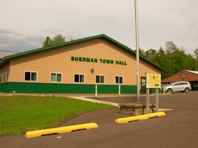
Location. 46° 1.653′ N, 90° 4.779′ W. Marker is near Springstead, Wisconsin, in Iron County. Marker is on State Highway 182, 7 miles west of State Highway 47-182, on the right when traveling east. Touch for map. Marker is in this post office area: Park Falls WI 54552, United States of America. Touch for directions.
Other nearby markers. At least 8 other markers are within 10 miles of this marker, measured as the crow flies. Flambeau Trail – Manitowish (approx. 7.9 miles away); Roddis Line – Turtle-Flambeau Dam (approx. 8.2 miles away); Flambeau Trail – Turtle Flambeau Flowage Dam (approx. 8.3 miles away); Lac du Flambeau (approx. 8.7 miles away); Veterans Memorial (approx. 8.8 miles away); Flambeau Trail – Two Ways to Go (approx. 9.3 miles away); Roddis Line – Lake of the Falls (approx. 9.3 miles away); Government Boarding School Boys Dormitory (approx. 9.3 miles away).
Credits. This page was last revised on June 16, 2016. It was originally submitted on September 14, 2012, by Paul Fehrenbach of Germantown, Wisconsin. This page has been viewed 618 times since then and 22 times this year. Photos: 1, 2, 3. submitted on September 14, 2012, by Paul Fehrenbach of Germantown, Wisconsin. • Bernard Fisher was the editor who published this page.


