Near Spotsylvania Courthouse in Spotsylvania County, Virginia — The American South (Mid-Atlantic)
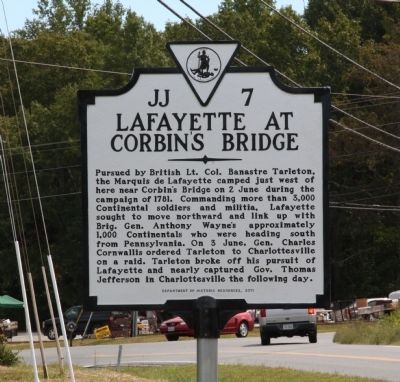
Lafayette at Corbinís Bridge
Erected 2012 by Department of Historic Resources and Mine Run Chapter Daughters of the American Revolution (DAR). (Marker Number JJ-7.)
Topics and series. This historical marker is listed in this topic list: War, US Revolutionary. In addition, it is included in the Daughters of the American Revolution, the Former U.S. Presidents: #03 Thomas Jefferson, and the Virginia Department of Historic Resources (DHR) series lists. A significant historical year for this entry is 1781.
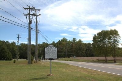
Location. 38° 14.857′ N, 77° 40.109′ W. Marker is near Spotsylvania Courthouse, Virginia, in Spotsylvania County. Marker is at the intersection of Brock Road (County Route 613) and Catharpin Road (County Route 612), on the left when traveling south on Brock Road. It is next to Toddís Marketís parking lot,and across the road from the Toddís Tavern wayside. Touch for map. Marker is at or near this postal address: 9626 Brock Road, Spotsylvania VA 22553, United States of America. Touch for directions.
Other nearby markers. At least 8 other markers are within 2 miles of this marker, measured as the crow flies. Toddís Tavern (a few steps from this marker); a different marker also named Toddís Tavern (a few steps from this marker); a different marker also named Toddís Tavern (a few steps from this marker); Chancellorsville Campaign (approx. 1.2 miles away); a different marker also named Chancellorsville Campaign (approx. 1.4 miles away); a different marker also named Chancellorsville Campaign (approx. 1.4 miles away); a different marker also named Chancellorsville Campaign (approx. 1.6 miles away); The Piney Branch School (approx. 1.8 miles away). Touch for a list and map of all markers in Spotsylvania Courthouse.
More about this marker. Marker is dated 2011 on its face, which reflects the year is was cast, but it was in fact erected in September, 2012 and dedicated on the 15th. It was sponsored by the Mine Run Chapter of the National Society, Daughters of the American Revolution.
Related marker. Click here for another marker that is related to this marker.
Also see . . . Lafayetteís Virginia Campaign 1781. “1 June 1781. Cornwallis, after making an excursion to Aylettís, re crossed the Chickahominy at Bottomís Bridge. He reached Cookís Ford on the North Anna River and stopped. He became aware that Wayneís force was getting close to joining up with Lafayette. Cornwallis decided to stop chasing Lafayette.
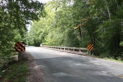
“2 June 1781. Lafayette reached Corbinís Bridge. He learned of the British evacuation of Camden, and the fall of Fort Motte, Orangeburg and Fort Granby. He received Greeneís dispatch, dated 16 May, that informed Lafayette of von Steubenís new orders to stay in Virginia.
“Unfortunately Greeneís instructions to von Steuben to this effect were intercepted and the Prussian remained in doubt for some time as to his line of command status. Von Steuben would not learn until 12 June that he had been ordered to stay in Virginia, and be under Lafayetteís command. Lafayette was sensitive to von Steubenís feelings, and never pushed the matter, though he was not fully aware of von Steuben misunderstanding.” (Submitted on September 16, 2012, by J. J. Prats of Powell, Ohio.)
Additional keywords. Campaign of 1781
Credits. This page was last revised on May 5, 2023. It was originally submitted on September 16, 2012, by J. J. Prats of Powell, Ohio. This page has been viewed 928 times since then and 46 times this year. Photos: 1, 2, 3. submitted on September 16, 2012, by J. J. Prats of Powell, Ohio.


