Baycliff in Galveston County, Texas — The American South (West South Central)
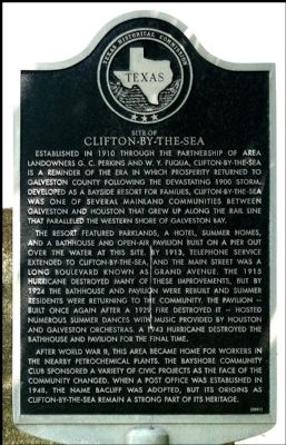
Site of Clifton-By-The-Sea
The resort featured parklands, a hotel, summer homes, and a bathhouse and open-air pavilion built on a pier out over the water at this site. By 1913, telephone service extended to Clifton-by-the-Sea, and the main street was a long boulevard known as Grand Avenue. The 1915 hurricane destroyed many of these improvements, but by 1924 the bathhouse and pavilion were rebuilt and summer residents were returning to the community. The pavilion-built once again after a 1929 fire destroyed it-hosted numerous summer dances with music provided by Houston and Galveston orchestras. A 1943 hurricane destroyed the bathhouse and pavilion for the final time.
After World War II, this area became home for workers in the nearby petrochemical plants. The Bayshore Community Club sponsored a variety of civic projects as the face of the community changed. When a post office was established in 1948, the name Bacliff was adopted, but its origins as Clifton-by-the-Sea remain a strong part of its heritage.
Erected 2001 by Texas Historical Commission. (Marker Number 12450.)
Topics. This historical marker is listed in this topic list: Settlements & Settlers. A significant historical year for this entry is 1910.
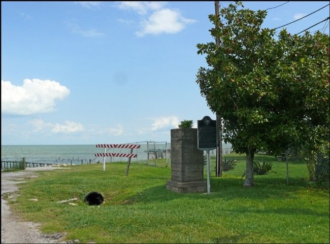
Location. 29° 30.669′ N, 94° 58.608′ W. Marker is in Baycliff, Texas, in Galveston County. Marker is on FM 646 near Boulevard Street, on the right when traveling east. Touch for map. Marker is in this post office area: Bacliff TX 77518, United States of America. Touch for directions.
Other nearby markers. At least 8 other markers are within 6 miles of this marker, measured as the crow flies. San Leon (approx. 1.2 miles away); Kemah (approx. 2.8 miles away); San Leon Veterans Memorial (approx. 2.9 miles away); San Leon Cemetery (approx. 2.9 miles away); Ritson Morris and Elmwood Plantation (approx. 4.7 miles away); Holy Trinity Episcopal Church (approx. 5.7 miles away); Prehistoric Indian Campsite (approx. 5.7 miles away); Faith United Methodist Church (approx. 6 miles away).
Also see . . .
1. Clifton-By-The-Sea (Now Named Baycliff) in The Handbook of Texas. (Submitted on September 18, 2012, by Jim Evans of Houston, Texas.)
2. Clifton-By-The-Sea (Now Named Baycliff) in Wikipedia. (Submitted on September 18, 2012, by Jim Evans of Houston, Texas.)
Additional commentary.
1. The name of Clifton-By-The-Sea
A couple of things are not explained on the marker:
1) The settlement was originally named Clifton-By-The-Sea. But, when they grew to need a post office, the U.S. Postal Service informed the residents the name Clifton-by-the-Sea was too long. So they chose to shorten it to Clifton. But, the USPS refused because there was already a Texas town with that name. So they settled on on "Bay Cliff," but the Post Office misspelled it naming it Baycliff.
2) What was once maybe the best seafood restaurant in the Houston Bay area, called 'Clifton by the Sea', was across the street from this marker. Note To Editor only visible by Contributor and editor
— Submitted May 23, 2020, by Jim Evans of Houston, Texas.
Additional keywords. N29° 30.669 W94° 58.608
Credits. This page was last revised on May 23, 2020. It was originally submitted on September 18, 2012, by Jim Evans of Houston, Texas. This page has been viewed 1,044 times since then and 95 times this year. Photos: 1, 2. submitted on September 18, 2012, by Jim Evans of Houston, Texas. • Craig Swain was the editor who published this page.

