Parowan in Iron County, Utah — The American Mountains (Southwest)
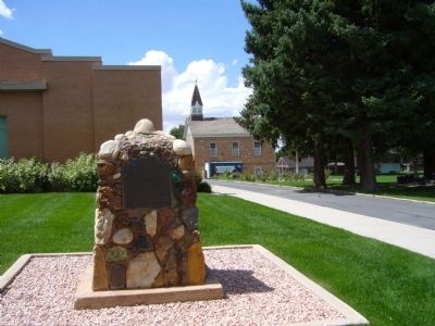
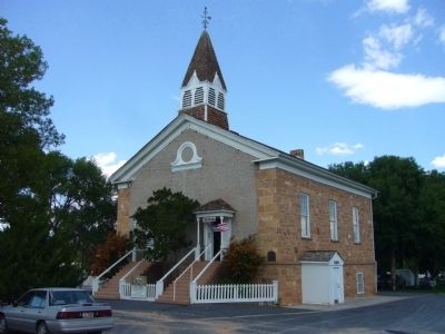
Pioneer Rock Church
Erected 1948 by Iron County Company, Daughters of Utah Pioneers. (Marker Number 122.)
Topics and series. This historical marker is listed in this topic list: Churches & Religion. In addition, it is included in the Daughters of Utah Pioneers series list. A significant historical year for this entry is 1863.
Location. 37° 50.463′ N, 112° 49.666′ W. Marker is in Parowan, Utah, in Iron County. Marker is on South Main Street, 0.1 miles south of Center Street, on the right when traveling south. Touch for map. Marker is in this post office area: Parowan UT 84761, United States of America. Touch for directions.
Other nearby markers. At least 8 other markers are within walking distance of this marker. Pioneer Sundial (within shouting distance of this marker); D.U.P. Relic Hall (about 300 feet away, measured in a direct line); An Original Hitching Ring (about 300 feet away); John C. Freemont Memorial (about 300 feet away); First School House and Council House in Iron County (about 300 feet away); Jesse N. Smith Home (about 400 feet away); a different marker also named Jesse N. Smith Home (about 400 feet away); William and Julia Lyman House (about 700 feet away). Touch for a list and map of all markers in Parowan.
Credits. This page was last revised on June 16, 2016. It was originally submitted on September 19, 2012, by Bill Kirchner of Tucson, Arizona. This page has been viewed 511 times since then and 34 times this year. Photos: 1, 2, 3. submitted on September 19, 2012, by Bill Kirchner of Tucson, Arizona. • Bill Pfingsten was the editor who published this page.


