Marker Logo HMdb.org THE HISTORICAL
MARKER DATABASE
“Bite-Size Bits of Local, National, and Global History”
Richmond Hill in Bryan County, Georgia — The American South (South Atlantic)
 

Canaan Church


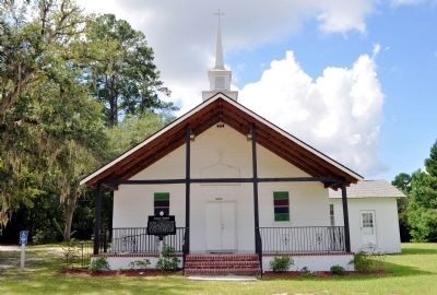
Canaan Church Marker image. Click for full size.
Photographed By David Seibert, September 26, 2012
1. Canaan Church Marker
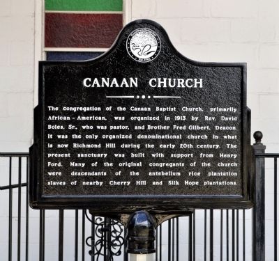
Inscription. The congregation of the Canaan Baptist Church, primarily African-American, was organized in 1913 by Rev. David Boles, Sr., who was pastor, and Brother Fred Gilbert, Deacon. It was the only organized denominational church in what is now Richmond Hill during the early 20th century. The present sanctuary was built with support from Henry Ford. Many of the original congregants of the church were descendants of the antebellum rice plantation slaves of nearby Cherry Hill and Silk Hope plantations.
 
Erected 2012 by Coastal Bryan Heritage Trail.
 
Topics. This historical marker is listed in these topic lists: African AmericansChurches & Religion. A significant historical year for this entry is 1913.
 
Location. 31° 56.233′ N, 81° 18.167′ W. Marker is in Richmond Hill, Georgia, in Bryan County. Marker is at the intersection of Henry Ford Avenue (Georgia Route 144) and Pinecrest Avenue, on the right when traveling east on Henry Ford Avenue. Touch for map. Marker is at or near this postal address: 10872 Henry Ford Avenue, Richmond Hill GA 31324, United States of America. Touch for directions.
 
Other nearby markers. At least 8 other markers are within walking distance of this marker. The "Bottom" Village (about 400 feet away, measured in a direct line); Ford Plantation Commissary (about 600 feet away); Ford Plantation Bakery (about 700 feet away); Martha-Mary Chapel
Paid Advertisement
Click on the ad for more information.
Please report objectionable advertising to the Editor.
Click or scan to see
this page online
(approx. 0.3 miles away); Community House (approx. 0.4 miles away); Henry Ford at Richmond Hill (approx. 0.6 miles away); J. F. Gregory (approx. 0.6 miles away); Kindergarten Building (approx. 0.6 miles away). Touch for a list and map of all markers in Richmond Hill.
 
Canaan Church Marker image. Click for full size.
Photographed By David Seibert, September 26, 2012
2. Canaan Church Marker
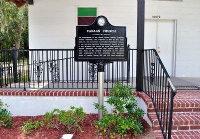
Canaan Church and Marker image. Click for full size.
Photographed By David Seibert, September 26, 2012
3. Canaan Church and Marker
Canaan Church and Marker image. Click for full size.
Photographed By David Seibert, September 26, 2012
4. Canaan Church and Marker
 
 
Credits. This page was last revised on June 16, 2016. It was originally submitted on October 1, 2012, by David Seibert of Sandy Springs, Georgia. This page has been viewed 624 times since then and 55 times this year. Photos:   1, 2, 3, 4. submitted on October 1, 2012, by David Seibert of Sandy Springs, Georgia. • Craig Swain was the editor who published this page.
Share this page.  
Share on Tumblr
m=59957

CeraNet Cloud Computing sponsors the Historical Marker Database.
This website earns income from purchases you make after using our links to Amazon.com. We appreciate your support.
Paid Advertisement
May. 9, 2024