
Downers Grove in DuPage County, Illinois — The American Midwest (Great Lakes)
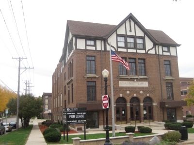
Masonic Temple
A Downers Grove Historic Site
— 1924 —
October 5, 2012
1. Masonic Temple Marker
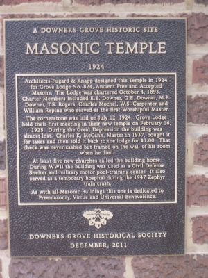
The cornerstone was laid on July 12, 1924. Grove Lodge held their first meeting in their new temple on February 16, 1925. During the Great Depression the building was almost lost. Charles K. McCann, Master in 1937, bought it for taxes and then sold it back to the lodge for $1.00. That check was never cashed but framed on the wall of his room when he died.
At least five new churches called the building home. During WWII the building was used as a Civil Defense Shelter and military motor pool-training center. It also served as a temporary hospital during the 1947 Zephyr train crash.
As with all Masonic Buildings this one is dedicated to Freemasonry, Virtue and Universal Benevolence.
Erected 2011 by Downers Grove Historical Society.
Topics. This historical marker is listed in these topic lists: Churches & Religion • Fraternal or Sororal Organizations • War, World II. A significant historical month for this entry is February 1816.
Location.
this page online
Other nearby markers. At least 8 other markers are within 6 miles of this marker, measured as the crow flies. Farmer's and Merchant's Bank Building (about 600 feet away, measured in a direct line); The Indian Boundary Line (about 700 feet away); Main Street Cemetery (about 800 feet away); a different marker also named Main Street Cemetery (approx. 0.2 miles away); Ben Fuller House (approx. 4½ miles away); Get Your "Chicks" on Rte 66 (approx. 4.9 miles away); Dell Rhea's Chicken Basket (approx. 4.9 miles away); Bruno F. Shustek (approx. 5.1 miles away). Touch for a list and map of all markers in Downers Grove.
October 5, 2012
2. Masonic Temple
Credits. This page was last revised on June 16, 2016. It was originally submitted on October 5, 2012. This page has been viewed 716 times since then and 25 times this year. Photos: 1, 2. submitted on October 5, 2012. • Bill Pfingsten was the editor who published this page.

