Near Holly Grove in Monroe County, Arkansas — The American South (West South Central)
Initial Point of the Louisiana Purchase Survey
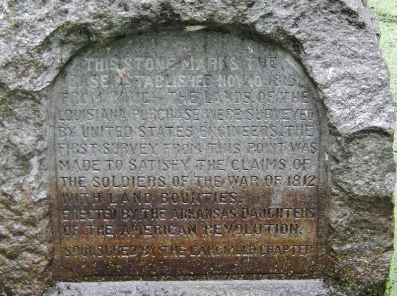
This stone marks the base established Nov. 10, 1815 from which the lands of the Louisiana Purchase were surveyed by the United States Engineers. The first survey from this point was made to satisfy the claims of the soldiers of the War of 1812 with land bounties.
Erected 1926 by Arkansas Daughters of the American Revolution.
Topics and series. This historical marker is listed in these topic lists: Landmarks • War of 1812. In addition, it is included in the Daughters of the American Revolution, and the National Historic Landmarks series lists. A significant historical date for this entry is November 10, 1815.
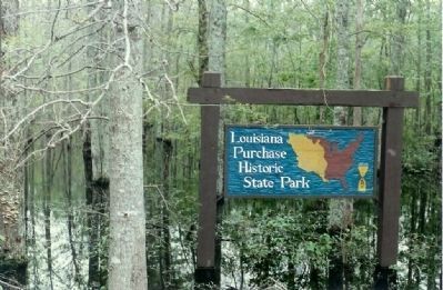
Location. 34° 38.742′ N, 91° 3.116′ W. Marker is near Holly Grove, Arkansas, in Monroe County. Marker is on Baseline Road (State Highway 362) 1.8 miles east of U.S. 49. At end of Baseline Road, in Louisiana Purchase State Park, walk 450 feet down the boardwalk into the swamp. Touch for map. Marker is in this post office area: Holly Grove AR 72069, United States of America. Touch for directions.
Other nearby markers. At least 8 other markers are within walking distance of this marker. The Opening of the American West (a few steps from this marker); Two Lines Mark the Future of the United States (a few steps from this marker); The Survey: 1815 (within shouting distance of this marker); Life in the Swamp (about 400 feet away, measured in a direct line); The Purchase: 1801-1803 (about 400 feet away); Louisiana Territory: 1682-1800 (about 400 feet away); The Swamp (about 400 feet away); Louisiana Purchase State Park (about 500 feet away). Touch for a list and map of all markers in Holly Grove.
More about this marker. Located at the junction of Lee, Monroe and Phillips Counties.
Related markers. Click here for a list of markers that are related to this marker. Louisiana Purchase Historic State Park
Also see . . .
1. Louisiana Purchase State Park. (Submitted on March 8, 2008, by Mike Stroud of Bluffton, South Carolina.)
2. Louisiana Purchase Survey. Article by John P. Gill in the Encyclopedia of Arkansas. Excerpt:
The official land survey of the Louisiana Purchase began in October 1815, when two land surveyors, Prospect Robbins and Joseph Brown, set out on their journey from the Mississippi River. ... Robbins began at the mouth of the Arkansas River and surveyed due north. Brown began several miles upstream at the mouth of the St. Francis River and proceeded due west. Brown’s survey line is called the baseline, and Robbins’s line is called the Fifth Principal Meridian because it was the fifth north-south line surveyed in the U.S.(Submitted on October 29, 2022.)
...
On November 10, 1815, Robbins crossed the baseline that had been set by Brown, who had already proceeded to the west of that point. Robbins sent for Brown, who returned to mark this intersection of their surveys as the Initial Point of the first survey of the American West. From this Initial Point, which is located in a headwater swamp at the northwest corner of Phillips County, the lands in Arkansas, Missouri, Iowa, North Dakota, and part of Minnesota and South Dakota are measured.
Credits. This page was last revised on November 2, 2022. It was originally submitted on March 8, 2008, by Mike Stroud of Bluffton, South Carolina. This page has been viewed 10,254 times since then and 486 times this year. It was the Marker of the Week October 30, 2022. Photos: 1. submitted on August 26, 2020, by Cosmos Mariner of Cape Canaveral, Florida. 2, 3, 4. submitted on March 8, 2008, by Mike Stroud of Bluffton, South Carolina. 5. submitted on March 18, 2011. • Craig Swain was the editor who published this page.


