L’Émergence du Christianisme
The Emergence of Christianity
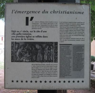
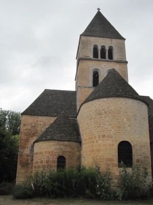
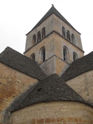
Already in the 5th Century, on the site of a Gallo-Roman villa, the first church was reflected in the river’s water. The villa of Saint-Léon-sur-Vézère, built around the 3rd or 4th centuries A.D., stretched out along the river bank as far as the present church square. In 1961, vestiges and the foundations of the first probably built around the 5th Century, were discovered. Wall with rubble stone covered by a coating for frescos, a marble column, and ceramic shards have been unearthed. The Roman building materials of the ancient church were undoubtedly reused until the 11th Century.
The nave, from the pre-Romanesque period, has openings with large arches that
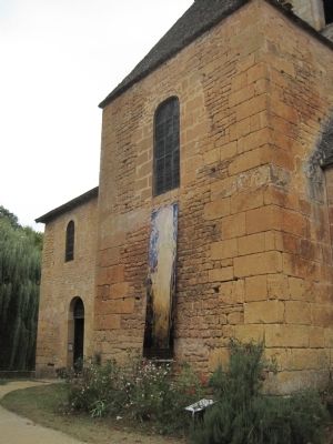
Saint-Léon-sur-Vézère attests to the long history of Christianity in the Périgord. The decline of religious practice began with the French Revolution. Due to lack of upkeep the edifice was already badly dilapidated when it was classified as a national Historic Monument in 1942. An absidiole crumbled in January 1960; a flood dangerously weakened the structure in October of the same year. Thanks to intelligent renovation work done between 1961 and 1966, this well-balanced church building recovered its former dignity.
The Emergence of Christianity
Water – a mirror for buildings, fishing preserve, and means of transportation – was, during the Gallo-Roman period, a decisive factor for chosing the spot to establish the villa where a house and agricultural outbuildings were grouped together around a courtyard.
Topics. This historical marker is listed in this topic list: Churches & Religion. A significant historical month for this entry is January 1960.
Location. 45° 0.58′ N, 1° 5.292′ E. Marker is in Saint-Léon-sur-Vézère, Nouvelle-Aquitaine (New Aquitaine), in Dordogne. Marker can be reached from Route D66. This marker is located near the church at St. Leon-sur-Vezere. Touch for map. Marker is in this post office area: Saint-Léon-sur-Vézère, Nouvelle-Aquitaine 24290, France. Touch for directions.
Other nearby markers. At least 8 other markers are within 18 kilometers of this marker, measured as the crow flies. Georges Grant MacCurdy (a few steps from this marker); Les Gravures et Peintures Prehistoriques de Rouffignac (approx. 7.9 kilometers away); Hôtel de Mirandol (approx. 16.6 kilometers
Additional commentary.
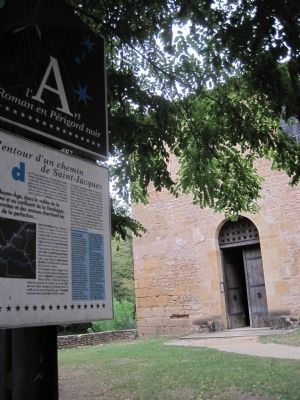
1. Alentour d’un Chemin de Saint-Jacques/Along one of the roads to Santiago de Compostela
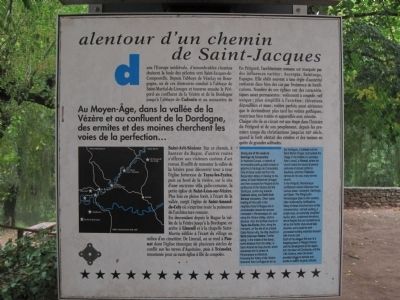
This text is found on the featured marker's reverse. It reads:
Au Moyen-Âge, dans la vallée de la Vézère et au confluent de la Dordogne des ermites et des moines cherchent les voies de la perfection.
Dans l'Europe médiévale, d'innombrables chemins drainent la foule des pèlerins vers Saint-Jacques-de-Compostelle. Depuis l'abbaye de Vézelay en Bourgogne, un de ces itinéraires conduit à l'abbaye de Saint-Martial-de-Limoges et traverse ensuite le Périgord au confluent de la Vézère et de la Dordogne jusqu'à l'abbaye de Cadouin et au monastère de Saint-Avit-Sénieur. Sur ce chemin, à hauteur du Bugue, d'autres routes s'offrent aux visiteurs curieux d'art
roman. Il suffit de remonter la vallée de la Vézère pour découvrir tour à tour l'église forteresse de Tayac-les-Eyzies, puis au bord de la rivière, sur le site d'une ancienne villa gallo-romaine, la petite église de Saint-Léon-sur-Vézère. Plus loin en pleine forêt, à l'écart de la vallée, surgit l'église de Saint-Amand-de-Coly où s'exprime toute la puissance de l'architecture romane.
En descendant depuis le Bugue la vallée de la Vézère jusqu'à la Dordogne, on arrive à Limeuil et à la chapelle Saint-Martin édifiée à l'écart du village au milieu d'un cimetière. De Limeuil, on se rend à Paunat dont l'église témoigne de plusieurs siècles de conflit sur les terres d'Aquitaine, puis à Trémolat renommée pour sa vaste église à file de coupoles.
En Périgord, l'architecture romane est marquée par des influences variées: Auvergne, Saintonge, Espagne. Elle obéit souvent à une règle d'austérité renforcée dans bien des cas par l'existence de fortifications. Nombre de ces églises ont des caractéristiques assez permanentes: voûtement à coupole; nef unique; plan simplifié à l'extrême; élévations
dépouillées et nues; voûtes parfois aussi aériennes que le deviendront plus tard les voûtes gothiques; matériaux bien traités et appareillés avec minutie.
Chaque site de ce circuit est une étape dans l'histoire du Périgord et de son peuplement, depuis les premiers temps du christianisme jusqu'au XIIIe siècle, quand la forêt abritait des ermites et des moines en quête de grandes solitudes.
Along one of the roads to Santiago de Compostela
In medieval Europe, a network of innumerable paths guided crowds of pilgrims to Santiago de Compostela. One of these routes led from the Burgundian abbey of Vézelay to the abbey of Saint-Martial-de-Limoges and then crossed the Périgord at the confluence of the Vézère and Dordogne, continuing toward Cadouin abbey and Saint-Avit-Senieur monastery. Other roads leading off this path in the neighbourhood of Bugue, are of considerable interest for anyone interested in Romanesque art. Just along the Vézère Valley, visitors discover, first, the fortified church of Tayac-les-Eyzies, then, along the riverbank, on the site of an ancient Gallo-Roman villa, the little church of Saint-Léon-sur-Vézère. Further along, in the middle of the forest, some distance from the valley, is Saint-Amand-de-Coly church, which expresses the full power of Romaneque architecture. Following the Valley of the Vézère downriver from Le Bugue as far as the Dordogne, is Lemeuil and Saint-Martin Chapel, built outside the village in the middle of a cemetery. After Limeuil, is Paunat, where the church bears the traces of several centuries of armed conflict in Aquitaine, and then Trémolat, famous for its vast and many-domed church.
In the Périgord, Romanesque architecture shows influences
Each of the sites on this tour is a stopping place in Périgord history and the development of the region, from the dawn of Christianity until the 13th century, when the forest provided refuge to hermits and monks in search of great solitude.
Credits. This page was last revised on November 6, 2018. It was originally submitted on October 19, 2012, by Barry Swackhamer of Brentwood, California. This page has been viewed 421 times since then and 5 times this year. Photos: 1, 2, 3, 4, 5, 6. submitted on October 19, 2012, by Barry Swackhamer of Brentwood, California. • Bill Pfingsten was the editor who published this page.
