Cricqueville-en-Bessin in Calvados, Normandy, France — Western Europe
Pointe du Hoc
Heroic Ranger Commandoes
| — | Colonel James E. Rudder | — |
Photographed by Barry Swackhamer, September 30, 2012
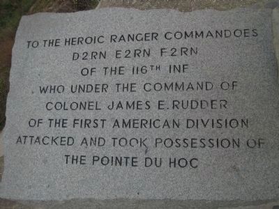
1. Pointe du Hoc Marker, English inscription

D2RN E2RN F2RN
Of the 116th Inf
Who under the command of
Colonel James E. Rudder
Of the First American Division
Attacked and took possession of the Pointe du Hoc
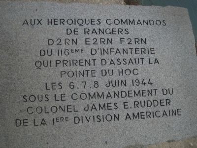
D2RN E2RN F2RN du 116eme d’Infanterie qui prirent d’assaut la Pointe du Hoc
Les 6.7.8 juin 1944 sous le commandement du Colonel James E. Rudder de la 1ere Division Americaine
Topics. This historical marker is listed in this topic list: War, World II. A significant historical year for this entry is 1944.
Location. 49° 23.837′ N, 0° 59.36′ W. Marker is in Cricqueville-en-Bessin, Normandie (Normandy), in Calvados. It can be reached from Rue Talbot. This marker is located on the battlefield near Pointe du Hoc. Touch for map. Marker is in this post office area: Cricqueville-en-Bessin, Normandie 14450, France. Touch for directions.

Regionally, it is in the North Atlantic Region, Europe, the European Union, Atlantic Europe, the Schengen Area, Western Europe, a coastal Mediterranean country, and the Western World. Historically, it finds itself in what was once a French colony
this page online
Other nearby markers. At least 8 other markers are within 3 kilometers of this marker, measured as the crow flies: Ranger Casualties (approx. 0.3 kilometers away); The Pointe-du-Hoc: the Feat of the 2nd Ranger Battalion (approx. 0.4 kilometers away); Bravery Under Fire (approx. half a kilometer away); Preparing to Invade (approx. half a kilometer away); a different marker also named Pointe du Hoc (approx. half a kilometer away); Les belles demeures / The beautiful houses (approx. 2.4 kilometers away); Le village / The village (approx. 2.4 kilometers away); Le patrimoine bâti / The built heritage (approx. 2.7 kilometers away). Touch for a list and map of all markers in Cricqueville-en-Bessin.
Photographed by Barry Swackhamer, September 30, 2012
2. Pointe du Hoc Marker, French inscription
Photographed by Barry Swackhamer, September 30, 2012
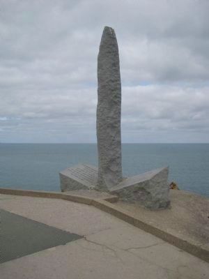
3. Pointe du Hoc Marker
This monument was designed to resemble a dagger plunged into the earth. The inscriptions are engraved onto the hilt.
Photographed by J. Makali Bruton, June 5, 2024
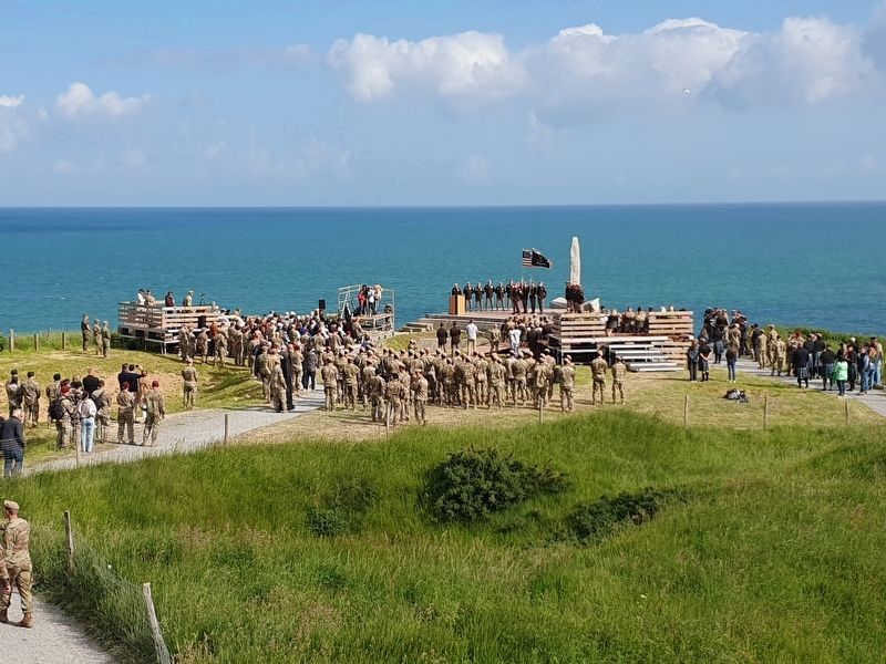
4. Pointe du Hoc Marker
This view is of the memorial ceremony on June 5, 2024.
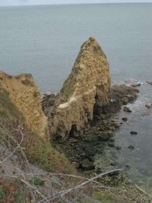
Photographed by Barry Swackhamer, September 30, 2012
5. Pointe du Hoc
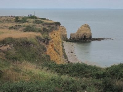
Photographed by Barry Swackhamer, September 30, 2012
6. The beach and cliff assaulted by the Rangers
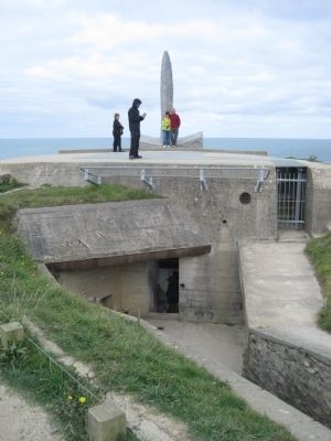
Photographed by Barry Swackhamer, September 30, 2012
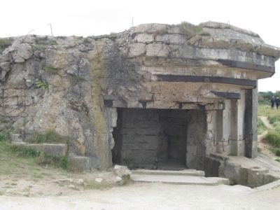
7. Entrance to the Observation Bunker and Machine Gun Position
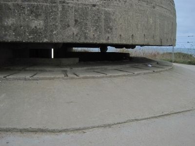
Photographed by Barry Swackhamer, September 30, 2012
8. Observation Bunker and Machine Gun Position
Photographed by Barry Swackhamer, September 30, 2012
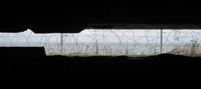
9. View of the English Channel from inside the Observation Bunker
Photographed by Barry Swackhamer, September 30, 2012
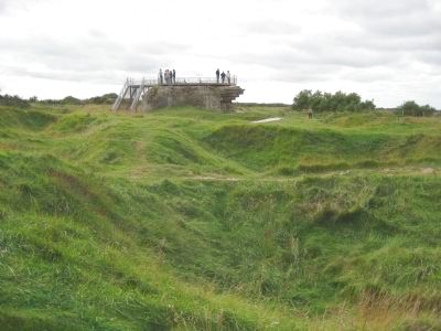
10. Gun Emplacement
Note bomb and shell craters are still visible.
Photographed by Barry Swackhamer, September 30, 2012
11. Gun Emplacement
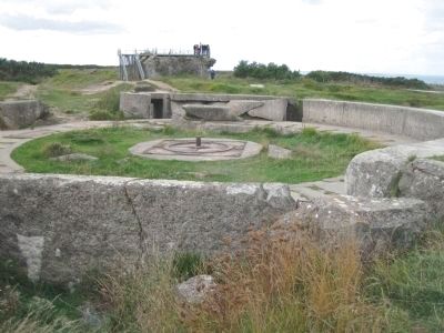
Photographed by Barry Swackhamer, September 30, 2012
12. Gun Emplacement
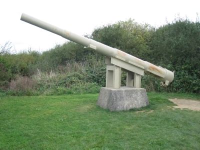
Photographed by Barry Swackhamer, September 30, 2012
13. 155mm Gun Position of D-Day
"The Germans, after suffering bombardment before D-Day, moved the surviving 155mm guns from Pointe du Hoc and repositioned them in a hedgerow south of this location. They erected dummy guns made from wooden poles to fool Allied aircraft. Rangers found and destroyed the actual guns, positioned to fire at Utah Beach, on the morning of D-Day. This recaptured gun is similar to the guns destroyed that day."
Point du Hoc pamphlet
Credits. This page was last revised on June 29, 2024. It was originally submitted on October 25, 2012, by Barry Swackhamer of Brentwood, California. This page has been viewed 1,204 times since then and 43 times this year. Photos: 1, 2, 3. submitted on October 25, 2012, by Barry Swackhamer of Brentwood, California. 4. submitted on June 20, 2024, by J. Makali Bruton of Washington, District of Columbia. 5, 6, 7, 8, 9, 10, 11, 12, 13. submitted on October 25, 2012, by Barry Swackhamer of Brentwood, California. • Bill Pfingsten was the editor who published this page.
